Area Overview for MK44 1RT
Photos of MK44 1RT
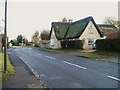
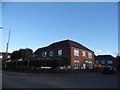
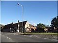
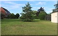

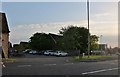
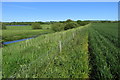
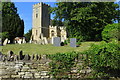
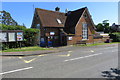
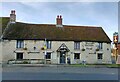
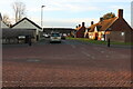
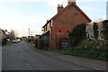
15 photos from this area
Area Information
Key information about the MK44 1RT including its size, population, and administrative classification.
- Area Type
- Postcode
- Area Size
- 7241 m²
- Population
- 1745
- Population Density
- 59 people/km²
House Prices in MK44 1RT
11
Properties
£352,364
Average Sold Price
£215,000
Lowest Price
£495,000
Highest Price
Showing 11 properties
| Address | Type | Beds | Baths | Last Sale Price | Last Sale Date | |
|---|---|---|---|---|---|---|
| 1 Butterfield Court, Milton Ernest, MK44 1RT | Detached | 4 | 3 | £495,000 | Dec 2024 | |
| 3 Butterfield Court, Milton Ernest, MK44 1RT | house | - | - | £385,000 | Aug 2023 | |
| 4 Butterfield Court, Milton Ernest, MK44 1RT | Detached | 5 | 3 | £438,000 | Dec 2020 | |
| 9 Butterfield Court, Milton Ernest, MK44 1RT | Detached | 4 | 2 | £467,000 | Nov 2020 | |
| 6 Butterfield Court, Milton Ernest, MK44 1RT | house | - | - | £291,000 | May 2019 | |
| 11 Butterfield Court, Milton Ernest, MK44 1RT | house | - | - | £478,000 | Aug 2016 | |
| 7 Butterfield Court, Milton Ernest, MK44 1RT | Semi-detached | 4 | - | £260,000 | May 2015 | |
| 5 Butterfield Court, Milton Ernest, MK44 1RT | house | - | - | £215,000 | Dec 2010 | |
| 10 Butterfield Court, Milton Ernest, MK44 1RT | Detached | 4 | - | £370,000 | Jan 2005 | |
| 2 Butterfield Court, Milton Ernest, MK44 1RT | Semi-detached | 4 | 2 | £227,000 | Sep 2004 |
Page 1 of 2
Energy Efficiency in MK44 1RT
Amenities
Schools
| Rank | School | Type | Entry gender | Ages |
|---|
Explore more schools in this area
Go to Schools tabDemographics
Household Size
Two person
most common
Accommodation Type
Houses
most common
Tenure
74
majority
Ethnic Group
White
most common
Religion
N/A
most common
Household Composition
N/A
most common
Age
47
median
Adults (30-64 years)
most common
Household Deprivation
N/A
with no deprivation
NS-SEC
43
in Lower managerial occupations
Explore more demographic insights in this area
Go to Demographics tabPlanning
Planning Constraints
- Flood RiskPremium
- Ramsar Wetland SitesPremium
- Area of Outstanding Natural BeautyPremium
- Protected Nature ReservePremium
- Protected WoodlandPremium