Area Overview for MK44 1RD
Photos of MK44 1RD
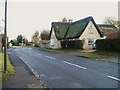
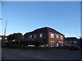
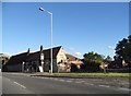
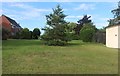
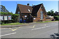
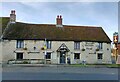
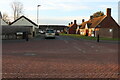
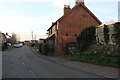
15 photos from this area
Area Information
Key information about the MK44 1RD including its size, population, and administrative classification.
- Area Type
- Postcode
- Area Size
- 1.6 hectares
- Population
- 1745
- Population Density
- 59 people/km²
House Prices in MK44 1RD
16
Properties
£220,188
Average Sold Price
£51,500
Lowest Price
£345,000
Highest Price
Showing 16 properties
| Address | Type | Beds | Baths | Last Sale Price | Last Sale Date | |
|---|---|---|---|---|---|---|
| 11 Church Close, Milton Ernest, MK44 1RD | Bungalow | - | - | £300,000 | Mar 2022 | |
| 12 Church Close, Milton Ernest, MK44 1RD | Chalet | 4 | - | £345,000 | Mar 2020 | |
| 5 Church Close, Milton Ernest, MK44 1RD | Semi-detached | 3 | 2 | £280,000 | Jan 2020 | |
| 3 Church Close, Milton Ernest, MK44 1RD | Bungalow | 3 | - | £250,000 | Oct 2014 | |
| 14 Church Close, Milton Ernest, MK44 1RD | Semi-detached | 3 | 2 | £165,000 | Nov 2008 | |
| 13 Church Close, Milton Ernest, MK44 1RD | Semi-detached | - | - | £183,000 | Oct 2008 | |
| 4 Church Close, Milton Ernest, MK44 1RD | Semi-detached | - | - | £187,000 | Nov 2005 | |
| 1 Church Close, Milton Ernest, MK44 1RD | Semi-detached | - | - | £51,500 | Oct 1996 | |
| 16 Church Close, Milton Ernest, MK44 1RD | house | - | - | - | - | |
| 2 Church Close, Milton Ernest, MK44 1RD | Semi-detached | - | - | - | - |
Page 1 of 2
Energy Efficiency in MK44 1RD
Amenities
Schools
| Rank | School | Type | Entry gender | Ages |
|---|
Explore more schools in this area
Go to Schools tabDemographics
Household Size
Two person
most common
Accommodation Type
Houses
most common
Tenure
74
majority
Ethnic Group
White
most common
Religion
N/A
most common
Household Composition
N/A
most common
Age
47
median
Adults (30-64 years)
most common
Household Deprivation
N/A
with no deprivation
NS-SEC
43
in Lower managerial occupations
Explore more demographic insights in this area
Go to Demographics tabPlanning
Planning Constraints
- Flood RiskPremium
- Ramsar Wetland SitesPremium
- Area of Outstanding Natural BeautyPremium
- Protected Nature ReservePremium
- Protected WoodlandPremium