Area Overview for MK44 1PR
Photos of MK44 1PR
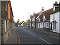
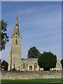
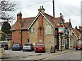
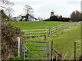
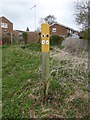
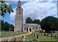
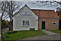
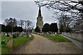
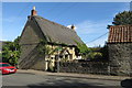
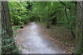
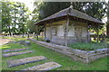
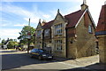
41 photos from this area
Area Information
Key information about the MK44 1PR including its size, population, and administrative classification.
- Area Type
- Postcode
- Area Size
- 2.1 hectares
- Population
- 1445
- Population Density
- 705 people/km²
House Prices in MK44 1PR
24
Properties
£251,083
Average Sold Price
£50,000
Lowest Price
£493,750
Highest Price
Showing 24 properties
| Address | Type | Beds | Baths | Last Sale Price | Last Sale Date | |
|---|---|---|---|---|---|---|
| 19 Normans Road, Sharnbrook, MK44 1PR | Semi-detached | 2 | 1 | £375,000 | Mar 2025 | |
| 21 Normans Road, Sharnbrook, MK44 1PR | Bungalow | - | - | £340,000 | Feb 2025 | |
| 2 Normans Road, Sharnbrook, MK44 1PR | house | - | - | £445,000 | Feb 2023 | |
| 25 Normans Road, Sharnbrook, MK44 1PR | Bungalow | - | - | £315,000 | Mar 2021 | |
| 7 Normans Road, Sharnbrook, MK44 1PR | Semi-detached | 6 | - | £460,000 | Nov 2020 | |
| 29 Normans Road, Sharnbrook, MK44 1PR | Bungalow | 3 | 1 | £345,000 | Oct 2019 | |
| 6A Normans Road, Sharnbrook, MK44 1PR | Bungalow | 4 | - | £493,750 | May 2015 | |
| 23 Normans Road, Sharnbrook, MK44 1PR | Bungalow | 3 | - | £230,000 | Apr 2011 | |
| 33 Normans Road, Sharnbrook, MK44 1PR | Bungalow | - | - | £200,000 | Jul 2006 | |
| 5 Normans Road, Sharnbrook, MK44 1PR | Semi-detached | - | - | £165,000 | Mar 2004 |
Page 1 of 3
Energy Efficiency in MK44 1PR
Amenities
Schools
| Rank | School | Type | Entry gender | Ages |
|---|
Explore more schools in this area
Go to Schools tabDemographics
Household Size
Two person
most common
Accommodation Type
Houses
most common
Tenure
79
majority
Ethnic Group
White
most common
Religion
N/A
most common
Household Composition
N/A
most common
Age
47
median
Adults (30-64 years)
most common
Household Deprivation
N/A
with no deprivation
NS-SEC
46
in Lower managerial occupations
Explore more demographic insights in this area
Go to Demographics tabPlanning
Planning Constraints
- Flood RiskPremium
- Ramsar Wetland SitesPremium
- Area of Outstanding Natural BeautyPremium
- Protected Nature ReservePremium
- Protected WoodlandPremium