Area Overview for MK44 1PB
Photos of MK44 1PB
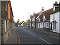
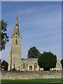
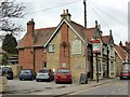
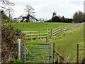
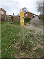
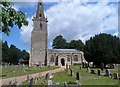
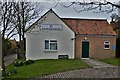
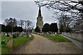
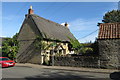
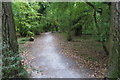
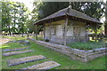
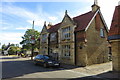
41 photos from this area
Area Information
Key information about the MK44 1PB including its size, population, and administrative classification.
- Area Type
- Postcode
- Area Size
- 1.5 hectares
- Population
- 1445
- Population Density
- 705 people/km²
House Prices in MK44 1PB
10
Properties
£197,600
Average Sold Price
£115,000
Lowest Price
£396,500
Highest Price
Showing 10 properties
| Address | Type | Beds | Baths | Last Sale Price | Last Sale Date | |
|---|---|---|---|---|---|---|
| 61 High Street, Sharnbrook, MK44 1PB | house | 2 | - | £130,000 | Jun 2011 | |
| 65 High Street, Sharnbrook, MK44 1PB | Cottage | 2 | 1 | £179,000 | Jan 2011 | |
| The Old Calf House, 67B High Street, Sharnbrook, MK44 1PB | Detached | - | - | £396,500 | Sep 2009 | |
| The Stables, 67A High Street, Sharnbrook, MK44 1PB | Detached | - | - | £167,500 | Feb 2001 | |
| Bullocks Barn, 69 High Street, Sharnbrook, MK44 1PB | Semi-detached | 5 | 4 | £115,000 | May 1998 | |
| 63A High Street, Sharnbrook, MK44 1PB | Maisonette | - | - | - | - | |
| Greensleeves Homes Trust, Sharnbrook House, High Street, Sharnbrook, MK44 1PB | Retirement | - | - | - | - | |
| 52 High Street, Sharnbrook, MK44 1PB | Detached | - | - | - | - | |
| Sharnbrook House, High Street, Sharnbrook, MK44 1PB | hospital_care_home | - | - | - | - | |
| Wardens Cottage, Sharnbrook House, High Street, Sharnbrook, MK44 1PB | Detached | - | - | - | - |
Energy Efficiency in MK44 1PB
Amenities
Schools
| Rank | School | Type | Entry gender | Ages |
|---|
Explore more schools in this area
Go to Schools tabDemographics
Household Size
Two person
most common
Accommodation Type
Houses
most common
Tenure
79
majority
Ethnic Group
White
most common
Religion
N/A
most common
Household Composition
N/A
most common
Age
47
median
Adults (30-64 years)
most common
Household Deprivation
N/A
with no deprivation
NS-SEC
46
in Lower managerial occupations
Explore more demographic insights in this area
Go to Demographics tabPlanning
Planning Constraints
- Flood RiskPremium
- Ramsar Wetland SitesPremium
- Area of Outstanding Natural BeautyPremium
- Protected Nature ReservePremium
- Protected WoodlandPremium