Area Overview for MK44 1NP
Photos of MK44 1NP
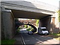
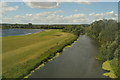
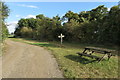
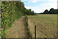
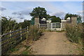
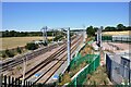
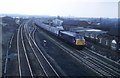
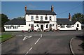
8 photos from this area
Area Information
Key information about the MK44 1NP including its size, population, and administrative classification.
- Area Type
- Postcode
- Area Size
- 68.0 hectares
- Population
- 1445
- Population Density
- 705 people/km²
House Prices in MK44 1NP
34
Properties
£419,406
Average Sold Price
£110,000
Lowest Price
£1,000,000
Highest Price
Showing 34 properties
| Address | Type | Beds | Baths | Last Sale Price | Last Sale Date | |
|---|---|---|---|---|---|---|
| 63 Mill Road, Sharnbrook, MK44 1NP | Detached | 3 | 1 | £370,000 | Jul 2025 | |
| 36 Mill Road, Sharnbrook, MK44 1NP | Bungalow | 3 | 1 | £560,000 | Jan 2025 | |
| 81 Mill Road, Sharnbrook, MK44 1NP | Detached | 4 | - | £1,000,000 | Dec 2021 | |
| Dunromin, 71 Mill Road, Sharnbrook, MK44 1NP | Semi-detached | - | - | £350,000 | Mar 2021 | |
| The Birches, 80 Mill Road, Sharnbrook, MK44 1NP | house | - | - | £445,000 | Mar 2021 | |
| 77 Mill Road, Sharnbrook, MK44 1NP | house | - | - | £440,000 | Jan 2021 | |
| 88A Mill Road, Sharnbrook, MK44 1NP | Detached | 4 | 2 | £675,000 | Feb 2019 | |
| Walnut Tree House, 67 Mill Road, Sharnbrook, MK44 1NP | house | - | - | £520,000 | May 2018 | |
| 53 Mill Road, Sharnbrook, MK44 1NP | house | - | - | £215,500 | Sep 2017 | |
| Bridge House, 65 Mill Road, Sharnbrook, MK44 1NP | house | 4 | - | £510,000 | Aug 2017 |
Page 1 of 4
Energy Efficiency in MK44 1NP
Amenities
Schools
| Rank | School | Type | Entry gender | Ages |
|---|
Explore more schools in this area
Go to Schools tabDemographics
Household Size
Two person
most common
Accommodation Type
Houses
most common
Tenure
79
majority
Ethnic Group
White
most common
Religion
N/A
most common
Household Composition
N/A
most common
Age
47
median
Adults (30-64 years)
most common
Household Deprivation
N/A
with no deprivation
NS-SEC
46
in Lower managerial occupations
Explore more demographic insights in this area
Go to Demographics tabPlanning
Planning Constraints
- Flood RiskPremium
- Ramsar Wetland SitesPremium
- Area of Outstanding Natural BeautyPremium
- Protected Nature ReservePremium
- Protected WoodlandPremium