Area Overview for MK43 9QP
Photos of MK43 9QP
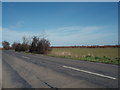
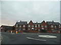
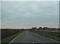
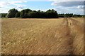
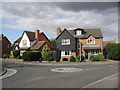
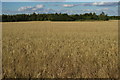
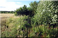

8 photos from this area
Area Information
Key information about the MK43 9QP including its size, population, and administrative classification.
- Area Type
- Postcode
- Area Size
- 1.3 hectares
- Population
- 2337
- Population Density
- 2144 people/km²
House Prices in MK43 9QP
26
Properties
£380,456
Average Sold Price
£258,748
Lowest Price
£580,000
Highest Price
Showing 26 properties
| Address | Type | Beds | Baths | Last Sale Price | Last Sale Date | |
|---|---|---|---|---|---|---|
| 7 Buckworth Drive, Wootton, MK43 9QP | Detached | 6 | 2 | £525,000 | Dec 2024 | |
| 5 Buckworth Drive, Wootton, MK43 9QP | Semi-detached | 3 | 2 | £347,500 | Jul 2024 | |
| 4 Buckworth Drive, Wootton, MK43 9QP | Detached | 4 | 2 | £470,000 | Oct 2023 | |
| 2 Buckworth Drive, Wootton, MK43 9QP | house | - | - | £580,000 | Dec 2022 | |
| 9 Buckworth Drive, Wootton, MK43 9QP | Semi-detached | 3 | 2 | £330,000 | Oct 2021 | |
| 19 Buckworth Drive, Wootton, MK43 9QP | house | - | - | £300,000 | Apr 2021 | |
| 25 Buckworth Drive, Wootton, MK43 9QP | house | - | - | £368,107 | Sep 2019 | |
| 23 Buckworth Drive, Wootton, MK43 9QP | Detached | 3 | 2 | £258,748 | Jul 2019 | |
| 16 Buckworth Drive, Wootton, MK43 9QP | house | - | - | £280,000 | Jul 2019 | |
| 20 Buckworth Drive, Wootton, MK43 9QP | house | - | - | £432,500 | Jun 2019 |
Page 1 of 3
Energy Efficiency in MK43 9QP
Amenities
Schools
| Rank | School | Type | Entry gender | Ages |
|---|
Explore more schools in this area
Go to Schools tabDemographics
Household Size
Family (3-5 people)
most common
Accommodation Type
Houses
most common
Tenure
78
majority
Ethnic Group
White
most common
Religion
N/A
most common
Household Composition
N/A
most common
Age
47
median
Adults (30-64 years)
most common
Household Deprivation
N/A
with no deprivation
NS-SEC
49
in Lower managerial occupations
Explore more demographic insights in this area
Go to Demographics tabPlanning
Planning Constraints
- Flood RiskPremium
- Ramsar Wetland SitesPremium
- Area of Outstanding Natural BeautyPremium
- Protected Nature ReservePremium
- Protected WoodlandPremium