Area Overview for MK43 9LZ
Photos of MK43 9LZ


Area Information
MK43 9LZ is a small, residential postcode area in England, home to 2,781 people spread across a compact cluster of homes. With a population density of 429 people per square kilometre, it reflects a tight-knit community where most residents own their homes. The area’s demographic profile is dominated by adults aged 30–64, with a median age of 47, suggesting a mature, stable population. Daily life here is likely shaped by proximity to local schools, rail stations, and retail hubs, offering a mix of practicality and convenience. The absence of major environmental constraints, such as protected woodlands or Areas of Outstanding Natural Beauty, means the area is free from planning restrictions that could complicate development or living. For buyers, MK43 9LZ presents a chance to settle in a low-risk, family-oriented environment where safety scores are strong and community ties are likely deep. Its small size means the area is ideal for those seeking a quiet, established neighbourhood without the sprawl of larger towns.
- Area Type
- Postcode
- Area Size
- Not available
- Population
- 2781
- Population Density
- 429 people/km²
The property market in MK43 9LZ is dominated by owner-occupied homes, with 77% of properties owned by residents. This high rate of home ownership suggests a community where long-term residency is common, rather than a rental market driven by transient tenants. The accommodation type is primarily houses, which are likely to be semi-detached or detached, given the area’s small size and residential character. This means the housing stock is not suited to investors seeking high turnover but is instead ideal for buyers looking for a stable, family-friendly environment. The limited number of properties in the area means buyers may need to consider nearby postcodes for a broader selection. For those prioritising permanence and a low-risk investment, MK43 9LZ offers a straightforward market with minimal planning constraints.
House Prices in MK43 9LZ
No properties found in this postcode.
Energy Efficiency in MK43 9LZ
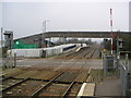
The lifestyle in MK43 9LZ is shaped by its proximity to practical amenities. Residents can access five rail stations, including Stewartby and Millbrook, which provide easy travel to nearby hubs. Retail options are plentiful, with Co-op outlets in Stewartby and Marston offering groceries and services. The presence of Cranfield Airport adds to the area’s appeal for those requiring travel connections. While the data does not specify dining or leisure venues, the availability of multiple retail points and transport links suggests a community focused on convenience and accessibility. The lack of detailed information on parks or recreational spaces means these aspects are not quantified, but the overall setup supports a lifestyle prioritising ease of movement and daily necessities.
Amenities
Schools
MK43 9LZ is served by a range of schools, including Broadmead Lower School, a primary school, and Marston Vale Middle School, which operates both as a primary school and an academy with an Ofsted rating of “good.” For older students, Kimberley 16–19 Stem College provides sixth-form education. The presence of both primary and secondary options within the area suggests families have access to a continuous education pathway without needing to relocate. The inclusion of an academy with a positive Ofsted rating indicates at least one school offering strong academic standards. However, the absence of data on school capacity or pupil numbers means it is unclear whether demand exceeds supply. For parents, the variety of school types provides flexibility, though proximity to specific institutions may vary depending on the exact location within the postcode.
| Rank | School | Type | Entry gender | Ages |
|---|
Explore more schools in this area
Go to Schools tabDemographics
The community in MK43 9LZ is predominantly composed of adults aged 30–64, with a median age of 47. This suggests a population skewed towards middle-aged residents, many of whom may be settled in long-term homes. Home ownership is high, with 77% of properties owned by their occupants, indicating a stable, less transient demographic. The area is characterised by houses rather than flats, reflecting a preference for traditional family homes. The predominant ethnic group is White, though no further breakdown of diversity is provided. The age profile and ownership figures suggest a community focused on long-term living, with fewer young families or students compared to other areas. The absence of specific data on deprivation means quality of life is inferred from the safety and infrastructure metrics, which are largely positive.
Household Size
Accommodation Type
Tenure
Ethnic Group
Religion
Household Composition
Age
Household Deprivation
NS-SEC
Explore more demographic insights in this area
Go to Demographics tabPlanning
Planning Constraints
- Flood RiskPremium
- Ramsar Wetland SitesPremium
- Area of Outstanding Natural BeautyPremium
- Protected Nature ReservePremium
- Protected WoodlandPremium