Area Overview for MK43 9LH
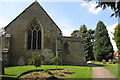
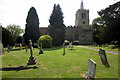
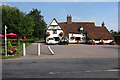
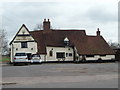
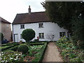
Photos of MK43 9LH


Area Information
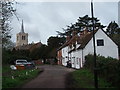
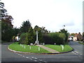
MK43 9LH is a compact residential postcode area in England, covering 4,177 square metres and home to 1,980 residents. Its high population density—473,981 people per square kilometre—reflects a tightly knit community. The area is characterised by a predominance of owner-occupied homes, with 70% of properties in private ownership. Most residents are adults aged 30–64, and the median age of 47 suggests a mature, stable population. Daily life here is shaped by proximity to essential services, including two primary schools and multiple retail outlets. The area’s small footprint means residents are likely to know their neighbours, though the density also implies a need for efficient local infrastructure. With no major environmental constraints or planning restrictions, MK43 9LH offers a straightforward, practical living environment. Its location near railway stations and Cranfield Airport provides connectivity, while the low crime risk and flood safety scores make it an appealing choice for families seeking a secure, well-served community.
- Area Type
- Postcode
- Area Size
- 4177 m²
- Population
- 1980
- Population Density
- 4374 people/km²
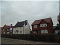
MK43 9LH is an owner-occupied area, with 70% of properties in private hands. The accommodation type is predominantly houses, indicating a lack of flats or apartments. This suggests a housing stock tailored to families and individuals seeking more space, rather than a rental market. The small area size and high population density imply limited land for new developments, which could make the property market competitive. Buyers should consider the scarcity of available homes, as the area’s compact nature may restrict expansion. The focus on houses also means that property values may reflect the demand for larger, more traditional homes. For those seeking a stable, low-risk investment, the high home ownership rate and absence of environmental constraints could be advantageous. However, the limited size of the area may mean that buyers need to look beyond MK43 9LH for additional options.
House Prices in MK43 9LH
No properties found in this postcode.
Energy Efficiency in MK43 9LH
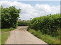
MK43 9LH offers a range of amenities within walking or short driving distance. Retail options include Tesco Wootton, Sainsburys Wootton, and Lidl Ridge, providing essential shopping and grocery needs. The area’s proximity to multiple railway stations—Kempston Hardwick, Stewartby, and Millbrook—facilitates easy travel to surrounding areas. Cranfield Airport is also nearby, adding to the transport options. While the data does not specify parks or leisure facilities, the presence of multiple retail outlets and transport links suggests a practical, convenience-focused lifestyle. The compact nature of the area means residents can access daily necessities without long commutes. The mix of retail and transport options supports a balanced lifestyle, combining local convenience with broader connectivity.
Amenities
Schools
Residents of MK43 9LH have access to two primary schools: Wootton Lower School and Wootton Primary School. Both institutions cater to younger children, providing a foundation for early education. The presence of two primary schools within proximity suggests a focus on supporting families with young children, though no secondary schools are listed in the data. The availability of two primary schools may reduce competition for places and offer parents a choice of educational settings. However, the absence of secondary school information means families may need to consider commuting for older children. The schools’ specific Ofsted ratings are not provided, so their performance cannot be assessed from this data alone. For those prioritising primary education, the proximity of these schools is a clear advantage.
| Rank | School | Type | Entry gender | Ages |
|---|
Explore more schools in this area
Go to Schools tabDemographics
The population of MK43 9LH is 1,980, with a median age of 47 and the majority of residents falling within the 30–64 age range. This suggests a community of established professionals and families. Home ownership is high, with 70% of properties owner-occupied, and the accommodation type is predominantly houses. The predominant ethnic group is White, though no data on diversity or deprivation is provided. The age profile indicates a mature population, which may influence local services and amenities. The high proportion of owner-occupied homes suggests a stable housing market, with fewer rental properties. This demographic mix likely shapes the area’s character, balancing the needs of long-term residents with those of newer households. The absence of specific data on income or deprivation means the quality of life cannot be fully assessed, but the age and ownership statistics point to a community focused on stability and long-term residence.
Household Size
Accommodation Type
Tenure
Ethnic Group
Religion
Household Composition
Age
Household Deprivation
NS-SEC
Explore more demographic insights in this area
Go to Demographics tabPlanning
Planning Constraints
- Flood RiskPremium
- Ramsar Wetland SitesPremium
- Area of Outstanding Natural BeautyPremium
- Protected Nature ReservePremium
- Protected WoodlandPremium