Area Overview for MK43 9LE
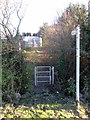
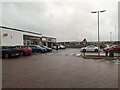
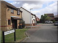
Photos of MK43 9LE


Area Information
Living in MK43 9LE offers a compact, tightly knit residential experience in a small cluster of homes. With a population of 2337 people and a density of 2144 people per square kilometre, this area is characterised by its close-knit community feel. The postcode sits in a region where daily life is shaped by proximity to essential services and transport links. Residents benefit from nearby retail hubs, including Sainsburys Wootton and Tesco Wootton, as well as railway stations like Kempston Hardwick and Stewartby, which provide easy access to surrounding towns. The area’s low crime risk score of 85 and absence of environmental constraints such as flood zones or protected natural sites make it an attractive option for families and professionals seeking stability. Its compact size means amenities are within practical reach, while the predominantly owner-occupied housing stock suggests a long-term, settled community. For those prioritising safety, convenience, and a manageable size, MK43 9LE presents a straightforward choice.
- Area Type
- Postcode
- Area Size
- Not available
- Population
- 2337
- Population Density
- 2144 people/km²
The property market in MK43 9LE is dominated by owner-occupied homes, with 78% of properties in private hands. This contrasts with rental markets, where ownership is lower, and suggests a community of long-term residents rather than short-term tenants. The accommodation type is primarily houses, which is unusual for areas with high population density but makes sense given the postcode’s small size and residential focus. This configuration implies limited availability of flats or apartments, which may be a consideration for buyers seeking alternative housing types. The compact nature of the area means property choices are limited to the immediate cluster, requiring buyers to evaluate proximity to amenities and transport links carefully. For those prioritising stability and family-oriented living, the market offers a straightforward, low-risk proposition.
House Prices in MK43 9LE
No properties found in this postcode.
Energy Efficiency in MK43 9LE
Residents of MK43 9LE have access to a range of nearby amenities, including five retail outlets such as Sainsburys Wootton, Tesco Wootton, and Co-op Stewartby. These shops provide essential grocery and household services, reducing the need for long journeys. The area’s railway stations—Kempston Hardwick, Stewartby, and Millbrook—offer regular connections to surrounding regions, facilitating both local and longer-distance travel. Cranfield Airport, though not a major hub, is within reach for those requiring air travel. The combination of retail, rail, and transport options creates a functional daily life, where errands and commutes are efficiently managed. The small size of the area means amenities are closely clustered, enhancing convenience for residents.
Amenities
Schools
| Rank | School | Type | Entry gender | Ages |
|---|
Explore more schools in this area
Go to Schools tabDemographics
The community in MK43 9LE is predominantly composed of adults aged 30–64, with a median age of 47. This suggests a mature, established population, likely with strong ties to local institutions and employment. Home ownership is high, at 78%, indicating a stable, long-term resident base rather than a transient rental market. The accommodation type is primarily houses, which aligns with the area’s low population density and family-oriented profile. The predominant ethnic group is White, reflecting a homogenous demographic. While no specific deprivation data is provided, the high home ownership rate and low crime risk suggest a generally secure and economically stable environment. This profile may appeal to buyers seeking a quiet, family-friendly setting with minimal disruption.
Household Size
Accommodation Type
Tenure
Ethnic Group
Religion
Household Composition
Age
Household Deprivation
NS-SEC
Explore more demographic insights in this area
Go to Demographics tabPlanning
Planning Constraints
- Flood RiskPremium
- Ramsar Wetland SitesPremium
- Area of Outstanding Natural BeautyPremium
- Protected Nature ReservePremium
- Protected WoodlandPremium