Area Overview for MK43 9AX
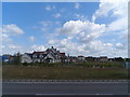
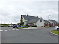
Photos of MK43 9AX


Area Information
MK43 9AX is a small residential cluster in England, covering just 2.2 hectares and home to 1725 people. Its population density of 77,808 people per square kilometre reflects a tightly packed community, typical of urban or semi-urban settings. The area is characterised by a mature demographic, with a median age of 47 and a majority of residents aged 30–64. Daily life here is shaped by proximity to local amenities and transport links. Residents can access nearby shops such as Sainsburys Kempston and Co-op Kempston, while rail stations like Bedford St Johns and Bedford provide connections to larger towns. The area’s compact size means it is practical for those prioritising convenience over space, though the high population density may influence the pace of life. With a home ownership rate of 42%, the area leans more towards rental properties, suggesting a mix of long-term residents and transient occupants. The presence of Balliol Primary School, rated ‘good’ by Ofsted, adds to the appeal for families seeking proximity to education. However, the area’s small footprint means it is best suited for those content with a compact, well-serviced environment.
- Area Type
- Postcode
- Area Size
- 2.2 hectares
- Population
- 1725
- Population Density
- 4967 people/km²
The property market in MK43 9AX is defined by a 42% home ownership rate, indicating that the majority of housing stock is rented rather than owner-occupied. This suggests a rental market that may cater to professionals or students seeking short-term accommodation. The area’s accommodation type is primarily houses, which is unusual for a small postcode area, potentially implying a mix of semi-detached or terraced homes. Given the compact size of the area, property availability is likely limited, and buyers should consider the broader surrounding region for options. The high population density may also influence property prices, with demand potentially outstripping supply. For those seeking a home in MK43 9AX, the focus should be on rental properties or smaller dwellings, as the area’s size restricts the diversity of housing types. Prospective buyers should also factor in the proximity to transport links and amenities when evaluating the area’s appeal.
House Prices in MK43 9AX
No properties found in this postcode.
Energy Efficiency in MK43 9AX
Life in MK43 9AX is shaped by its proximity to essential amenities. Residents can access five retail venues, including Spar and Sainsburys Kempston, offering everyday shopping convenience. The area’s rail links to Bedford and surrounding towns provide easy access to larger retail hubs, dining options, and cultural attractions. While the data does not mention parks or leisure facilities, the presence of multiple rail stations suggests that outdoor activities may be available in nearby areas. The compact nature of the postcode means that daily errands and social interactions are within walking or short driving distance. For those valuing convenience over expansive green spaces, the area’s amenities are practical, though the lack of specific leisure facilities may require residents to travel slightly further for recreation. The blend of retail and transport options supports a lifestyle focused on efficiency and accessibility.
Amenities
Schools
The nearest school to MK43 9AX is Balliol Primary School, which provides education for younger children and holds a ‘good’ Ofsted rating. This school is a key consideration for families prioritising proximity to education, though the data does not list any secondary schools or further education institutions in the immediate area. The presence of a primary school with a positive rating suggests a baseline level of educational quality, but parents seeking a full range of schooling options may need to look beyond MK43 9AX. The lack of additional schools in the data implies that families may need to travel to nearby towns for secondary education or specialist provisions. For those valuing convenience, the location of Balliol Primary School is a practical asset, but the absence of broader educational facilities should be factored into long-term planning.
| Rank | School | Type | Entry gender | Ages |
|---|
Explore more schools in this area
Go to Schools tabDemographics
The community in MK43 9AX is predominantly composed of adults aged 30–64, with a median age of 47. This suggests a mature population, likely with established careers and family commitments. Home ownership stands at 42%, indicating that nearly half of residents rent their homes, which may reflect a mix of younger professionals and those in transient employment. The area is primarily composed of houses, aligning with the demographic profile of older, settled residents. The predominant ethnic group is White, though specific data on diversity or deprivation is not provided. The high population density of 77,808 people per square kilometre implies a tightly knit community, but it also raises questions about the availability of green spaces or private outdoor areas. For those prioritising a quiet, stable environment, the age profile and housing stock suggest a low turnover of residents. However, the lack of data on deprivation or socioeconomic diversity means the full picture of quality of life remains partially obscured.
Household Size
Accommodation Type
Tenure
Ethnic Group
Religion
Household Composition
Age
Household Deprivation
NS-SEC
Explore more demographic insights in this area
Go to Demographics tabPlanning
Planning Constraints
- Flood RiskPremium
- Ramsar Wetland SitesPremium
- Area of Outstanding Natural BeautyPremium
- Protected Nature ReservePremium
- Protected WoodlandPremium