Area Overview for MK43 9AF
Photos of MK43 9AF

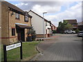
19 photos from this area
Area Information
Key information about the MK43 9AF including its size, population, and administrative classification.
- Area Type
- Postcode
- Area Size
- 6311 m²
- Population
- 1882
- Population Density
- 251 people/km²
House Prices in MK43 9AF
27
Properties
£236,573
Average Sold Price
£77,500
Lowest Price
£362,500
Highest Price
Showing 27 properties
| Address | Type | Beds | Baths | Last Sale Price | Last Sale Date | |
|---|---|---|---|---|---|---|
| 6 Sherwood Close, Wootton, MK43 9AF | Detached | 3 | 2 | £362,500 | Sep 2025 | |
| 16 Sherwood Close, Wootton, MK43 9AF | house | - | - | £325,000 | Dec 2024 | |
| 15 Sherwood Close, Wootton, MK43 9AF | Flat | - | - | £77,500 | Oct 2022 | |
| 31 Sherwood Close, Wootton, MK43 9AF | Terraced | 2 | 1 | £220,000 | Mar 2019 | |
| 33 Sherwood Close, Wootton, MK43 9AF | house | - | - | £282,000 | Dec 2018 | |
| 12 Sherwood Close, Wootton, MK43 9AF | Terraced | 3 | 3 | £280,000 | Nov 2018 | |
| 20 Sherwood Close, Wootton, MK43 9AF | house | - | - | £291,000 | Mar 2017 | |
| 3 Sherwood Close, Wootton, MK43 9AF | Terraced | 2 | 1 | £187,000 | Mar 2015 | |
| 5 Sherwood Close, Wootton, MK43 9AF | house | - | - | £180,000 | May 2012 | |
| 27 Sherwood Close, Wootton, MK43 9AF | Terraced | 3 | 3 | £186,595 | Jan 2012 |
Page 1 of 3
Energy Efficiency in MK43 9AF
Amenities
Schools
| Rank | School | Type | Entry gender | Ages |
|---|
Explore more schools in this area
Go to Schools tabDemographics
Household Size
Family (3-5 people)
most common
Accommodation Type
Houses
most common
Tenure
79
majority
Ethnic Group
White
most common
Religion
N/A
most common
Household Composition
N/A
most common
Age
47
median
Adults (30-64 years)
most common
Household Deprivation
N/A
with no deprivation
NS-SEC
44
in Lower managerial occupations
Explore more demographic insights in this area
Go to Demographics tabPlanning
Planning Constraints
- Flood RiskPremium
- Ramsar Wetland SitesPremium
- Area of Outstanding Natural BeautyPremium
- Protected Nature ReservePremium
- Protected WoodlandPremium