Area Overview for MK43 8TS
Photos of MK43 8TS

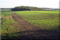
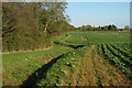
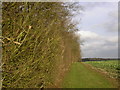
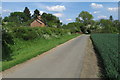
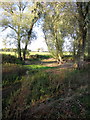
7 photos from this area
Area Information
Key information about the MK43 8TS including its size, population, and administrative classification.
- Area Type
- Postcode
- Area Size
- 1.4 km²
- Population
- 1599
- Population Density
- 69 people/km²
House Prices in MK43 8TS
19
Properties
£757,136
Average Sold Price
£595,000
Lowest Price
£999,950
Highest Price
Showing 19 properties
| Address | Type | Beds | Baths | Last Sale Price | Last Sale Date | |
|---|---|---|---|---|---|---|
| Dylwick Lodge, Wick End, Stagsden, MK43 8TS | Bungalow | 3 | 2 | £860,000 | Aug 2023 | |
| Hobbs Barn, Wick End, Stagsden, MK43 8TS | house | - | - | £710,000 | Dec 2021 | |
| The New Barn, Wick End, Stagsden, MK43 8TS | Detached | - | - | £685,000 | Jun 2020 | |
| The Elms, Wick End, Stagsden, MK43 8TS | Bungalow | 3 | 1 | £595,000 | Dec 2018 | |
| High View, Wick End, Stagsden, MK43 8TS | Detached | 5 | - | £750,000 | Oct 2014 | |
| The Old Barn, Wick End, Stagsden, MK43 8TS | Detached | 5 | - | £700,000 | Nov 2013 | |
| The Roost, Wick End, Stagsden, MK43 8TS | house | - | - | £999,950 | Feb 2013 | |
| Wick End Farm, Wick End Farmhouse, Wick End, Stagsden, MK43 8TS | office_workshop | 5 | 3 | - | - | |
| Annexe, Wick End House, Wick End, Stagsden, MK43 8TS | Flat | - | - | - | - | |
| Howbrook Farm, Wick End, Stagsden, MK43 8TS | house | - | - | - | - |
Page 1 of 2
Energy Efficiency in MK43 8TS
Amenities
Schools
| Rank | School | Type | Entry gender | Ages |
|---|
Explore more schools in this area
Go to Schools tabDemographics
Household Size
Two person
most common
Accommodation Type
Houses
most common
Tenure
87
majority
Ethnic Group
White
most common
Religion
N/A
most common
Household Composition
N/A
most common
Age
47
median
Adults (30-64 years)
most common
Household Deprivation
N/A
with no deprivation
NS-SEC
43
in Lower managerial occupations
Explore more demographic insights in this area
Go to Demographics tabPlanning
Planning Constraints
- Flood RiskPremium
- Ramsar Wetland SitesPremium
- Area of Outstanding Natural BeautyPremium
- Protected Nature ReservePremium
- Protected WoodlandPremium