Area Overview for MK43 8SR
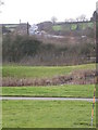
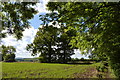
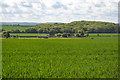
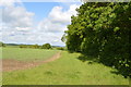
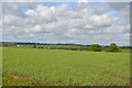
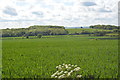
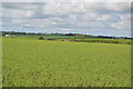
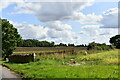
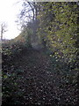
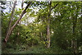
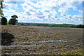
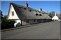
Photos of MK43 8SR
Area Information
Living in MK43 8SR offers a quiet, residential lifestyle in a small cluster of homes. With a population of 1,599 and a density of 69 people per square kilometre, the area feels intimate rather than crowded. It is a typical English suburb, where most properties are houses, and the community is largely composed of adults aged 30–64. The postcode covers a compact neighbourhood, ideal for those seeking a stable, low-traffic environment. Proximity to Bedford and nearby rail links makes it accessible for commuters, while the absence of major planning constraints means new developments are unlikely to disrupt the existing character. Daily life here is defined by local amenities, including nearby shops and schools, and a generally low crime rate. For buyers, MK43 8SR represents a balance between seclusion and connectivity, with homes that are predominantly owner-occupied, reflecting a community of long-term residents.
- Area Type
- Postcode
- Area Size
- Not available
- Population
- 1599
- Population Density
- 69 people/km²
MK43 8SR is a predominantly owner-occupied area, with 87% of homes owned by residents rather than rented out. The housing stock is almost entirely composed of houses, which suggests a focus on family homes and long-term living rather than apartments or flats. This makes the area appealing to buyers seeking traditional, spacious properties with potential for future value retention. However, the small size of the postcode means the market is limited to a handful of properties, which could lead to competition among buyers. The high home ownership rate also indicates a lack of rental demand, which may mean fewer short-term tenants but a more consistent buyer base. For those considering the area, the limited number of homes means thorough research into each property is essential to understand its unique features and potential.
House Prices in MK43 8SR
No properties found in this postcode.
Energy Efficiency in MK43 8SR
Residents of MK43 8SR have access to a range of local amenities within easy reach. Retail options include The Southern Co-operative Co, Sainsburys Bedford, and Lidl Ridge, providing everyday shopping needs. The proximity to Bedford Railway Station and other nearby stations ensures convenient travel for work or leisure. Cranfield Airport is also accessible, adding to the area’s transport versatility. While the area is small, it is positioned to benefit from Bedford’s larger amenities, which include cultural venues, parks, and dining options. The mix of retail, transport, and regional connectivity creates a lifestyle that balances convenience with a sense of local identity. For families, the availability of schools and community spaces nearby further enhances the appeal of daily life in MK43 8SR.
Amenities
Schools
| Rank | School | Type | Entry gender | Ages |
|---|
Explore more schools in this area
Go to Schools tabDemographics
The population of MK43 8SR is predominantly adults aged 30–64, with a median age of 47. This suggests a mature, established community, likely with families and professionals settled in the area. Home ownership is high at 87%, indicating a stable housing market with few rental properties. The accommodation is almost entirely houses, which aligns with the demographic profile of older, family-oriented residents. The predominant ethnic group is White, reflecting the broader regional trend. The low population density of 69 people per square kilometre means the area is not densely packed, offering space and privacy. This combination of factors—older residents, high home ownership, and a focus on single-family homes—creates a neighbourhood that prioritises stability over rapid change.
Household Size
Accommodation Type
Tenure
Ethnic Group
Religion
Household Composition
Age
Household Deprivation
NS-SEC
Explore more demographic insights in this area
Go to Demographics tabPlanning
Planning Constraints
- Flood RiskPremium
- Ramsar Wetland SitesPremium
- Area of Outstanding Natural BeautyPremium
- Protected Nature ReservePremium
- Protected WoodlandPremium