Area Overview for MK43 8LW
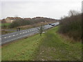
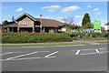
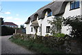
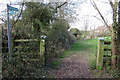
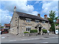
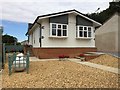
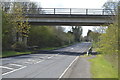
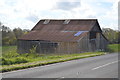
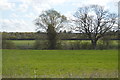
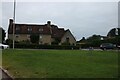
Photos of MK43 8LW
Area Information
MK43 8LW is a small, tightly knit residential postcode in England, home to 1,585 people spread across a compact area with a density of 553 people per square kilometre. This suggests a closely connected community where daily life is likely shaped by proximity to local amenities and neighbours. The area’s demographic profile indicates a mature population, with a median age of 47 and the majority of residents falling within the 30-64 age range. Most homes are owner-occupied, with 89% of properties owned by their residents, reflecting a stable, long-term community. The housing stock is predominantly composed of houses, which may appeal to those seeking traditional family homes. Nearby, the Southern Co-operative and Sainsburys Bedford provide retail convenience, while multiple railway stations offer easy access to surrounding towns. For families, the presence of Rainbow School—a special school—adds a layer of support for specific educational needs. The area’s low crime risk and absence of environmental constraints like protected woodlands or wetlands suggest a practical, low-stress environment for living.
- Area Type
- Postcode
- Area Size
- Not available
- Population
- 1585
- Population Density
- 553 people/km²
The property market in MK43 8LW is characterised by high home ownership, with 89% of properties owned by their residents. This suggests a stable, long-term market where investment in property is likely to be a priority for buyers. The accommodation type is predominantly houses, which may appeal to those seeking traditional family homes with private outdoor space. Given the small size of the postcode area, the housing stock is likely limited in volume, meaning buyers may need to consider nearby regions for more options. The high home ownership rate also indicates that rental properties are relatively scarce, making this area more attractive to those seeking ownership rather than tenancy. For buyers, this could mean a competitive market with fewer available properties, but the presence of houses may offer greater long-term value and security.
House Prices in MK43 8LW
No properties found in this postcode.
Energy Efficiency in MK43 8LW
Living in MK43 8LW offers access to a range of local amenities within practical reach. Retail options include five nearby stores, such as Sainsburys Bedford, Budgens Clapham, and The Southern Co-operative, providing everyday shopping convenience. The area’s rail network, with stations like Bedford and Kempston Hardwick, ensures easy access to regional hubs, whether for commuting or socialising. While the data does not mention parks or leisure facilities, the absence of planning constraints like protected woodlands or AONBs suggests that development has prioritised residential and retail needs. The combination of shops, rail links, and a low crime risk contributes to a practical, low-stress lifestyle. For those who value convenience and connectivity, MK43 8LW offers a balance of local services and transport options that support both daily living and broader mobility.
Amenities
Schools
The nearest school to MK43 8LW is Rainbow School, a special school. This suggests that the area may cater to families with children who require tailored educational support, though it does not provide mainstream primary or secondary schooling. The absence of other schools in the data means that families seeking a broader range of educational options may need to look further afield. The presence of a special school could indicate a community with specific needs or a focus on inclusivity, but it also highlights the importance of considering proximity to other educational institutions when evaluating the area. Parents should assess whether Rainbow School meets their child’s requirements or if additional travel is necessary for mainstream schooling.
| Rank | School | Type | Entry gender | Ages |
|---|
Explore more schools in this area
Go to Schools tabDemographics
The population of MK43 8LW is predominantly composed of adults aged 30-64, with a median age of 47. This indicates a community that is largely settled, with few young families or retirees. Home ownership is exceptionally high at 89%, which suggests a strong sense of stability and long-term residency. The accommodation type is primarily houses, which may reflect a preference for private, standalone living spaces over flats or apartments. The predominant ethnic group is White, which aligns with broader trends in the region but does not provide detailed insight into cultural diversity. The absence of specific data on deprivation or socioeconomic distribution means the quality of life here cannot be fully assessed in those terms. However, the high home ownership rate and mature age profile suggest a community focused on comfort and continuity rather than rapid change or growth.
Household Size
Accommodation Type
Tenure
Ethnic Group
Religion
Household Composition
Age
Household Deprivation
NS-SEC
Explore more demographic insights in this area
Go to Demographics tabPlanning
Planning Constraints
- Flood RiskPremium
- Ramsar Wetland SitesPremium
- Area of Outstanding Natural BeautyPremium
- Protected Nature ReservePremium
- Protected WoodlandPremium