Area Overview for MK43 8DU
Photos of MK43 8DU
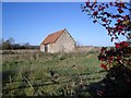
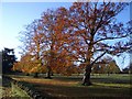


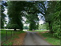
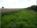
9 photos from this area
Area Information
Key information about the MK43 8DU including its size, population, and administrative classification.
- Area Type
- Postcode
- Area Size
- 54.5 hectares
- Population
- 1192
- Population Density
- 73 people/km²
House Prices in MK43 8DU
31
Properties
£423,353
Average Sold Price
£148,500
Lowest Price
£885,000
Highest Price
Showing 31 properties
| Address | Type | Beds | Baths | Last Sale Price | Last Sale Date | |
|---|---|---|---|---|---|---|
| Rosslyn, Norfolk Road, Turvey, MK43 8DU | house | - | - | £790,000 | Aug 2023 | |
| Carsebreck, Norfolk Road, Turvey, MK43 8DU | Detached | 4 | 3 | £550,000 | Jul 2023 | |
| Meadow House, Norfolk Road, Turvey, MK43 8DU | house | - | - | £885,000 | Jun 2022 | |
| Fairview, Norfolk Road, Turvey, MK43 8DU | house | 3 | - | £390,000 | Feb 2021 | |
| Primrose Cottage, Norfolk Road, Turvey, MK43 8DU | house | - | - | £325,000 | Apr 2019 | |
| 33 Norfolk Road, Turvey, MK43 8DU | Detached | 5 | 3 | £622,500 | Jan 2018 | |
| Holmdale, Norfolk Road, Turvey, MK43 8DU | house | - | - | £485,000 | Oct 2016 | |
| 31 Norfolk Road, Turvey, MK43 8DU | Detached | 5 | - | £575,000 | Jul 2016 | |
| Mowbray, Norfolk Road, Turvey, MK43 8DU | house | 4 | - | £292,500 | Sep 2015 | |
| Highfield, Norfolk Road, Turvey, MK43 8DU | house | - | - | £558,000 | Jul 2015 |
Page 1 of 4
Energy Efficiency in MK43 8DU
Amenities
Schools
| Rank | School | Type | Entry gender | Ages |
|---|
Explore more schools in this area
Go to Schools tabDemographics
Household Size
Two person
most common
Accommodation Type
Houses
most common
Tenure
74
majority
Ethnic Group
White
most common
Religion
N/A
most common
Household Composition
N/A
most common
Age
47
median
Adults (30-64 years)
most common
Household Deprivation
N/A
with no deprivation
NS-SEC
47
in Lower managerial occupations
Explore more demographic insights in this area
Go to Demographics tabPlanning
Planning Constraints
- Flood RiskPremium
- Ramsar Wetland SitesPremium
- Area of Outstanding Natural BeautyPremium
- Protected Nature ReservePremium
- Protected WoodlandPremium