Area Overview for MK43 8DS
Photos of MK43 8DS
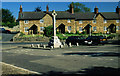
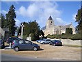
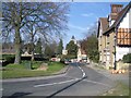
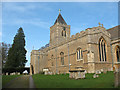
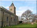
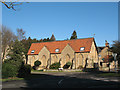
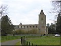
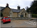


70 photos from this area
Area Information
Key information about the MK43 8DS including its size, population, and administrative classification.
- Area Type
- Postcode
- Area Size
- 6736 m²
- Population
- 1192
- Population Density
- 73 people/km²
House Prices in MK43 8DS
11
Properties
£323,750
Average Sold Price
£192,000
Lowest Price
£480,000
Highest Price
Showing 11 properties
| Address | Type | Beds | Baths | Last Sale Price | Last Sale Date | |
|---|---|---|---|---|---|---|
| Stoneways, Bamfords Lane, Turvey, MK43 8DS | Bungalow | - | - | £355,000 | Jul 2015 | |
| Eventide, Bamfords Lane, Turvey, MK43 8DS | house | - | - | £480,000 | Feb 2010 | |
| Peppers, Bamfords Lane, Turvey, MK43 8DS | Semi-detached | - | - | £268,000 | Aug 2007 | |
| Thorndale, Bamfords Lane, Turvey, MK43 8DS | Detached | 4 | 1 | £192,000 | Oct 2003 | |
| Allenise, Bamfords Lane, Turvey, MK43 8DS | Bungalow | 2 | 1 | - | - | |
| The Rectory, Bamfords Lane, Turvey, MK43 8DS | house | 3 | 1 | - | - | |
| Birchfield, Bamfords Lane, Turvey, MK43 8DS | Detached | - | - | - | - | |
| Troy House, Bamfords Lane, Turvey, MK43 8DS | Detached | - | - | - | - | |
| Celyn, Bamfords Lane, Turvey, MK43 8DS | house | - | - | - | - | |
| Penwith, Bamfords Lane, Turvey, MK43 8DS | Detached | - | - | - | - |
Page 1 of 2
Energy Efficiency in MK43 8DS
Amenities
Schools
| Rank | School | Type | Entry gender | Ages |
|---|
Explore more schools in this area
Go to Schools tabDemographics
Household Size
Two person
most common
Accommodation Type
Houses
most common
Tenure
74
majority
Ethnic Group
White
most common
Religion
N/A
most common
Household Composition
N/A
most common
Age
47
median
Adults (30-64 years)
most common
Household Deprivation
N/A
with no deprivation
NS-SEC
47
in Lower managerial occupations
Explore more demographic insights in this area
Go to Demographics tabPlanning
Planning Constraints
- Flood RiskPremium
- Ramsar Wetland SitesPremium
- Area of Outstanding Natural BeautyPremium
- Protected Nature ReservePremium
- Protected WoodlandPremium