Area Overview for MK43 7RA
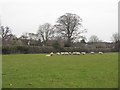
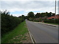
Photos of MK43 7RA


Area Information
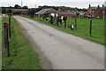
Living in MK43 7RA means being part of a compact residential cluster in England, home to 2,510 people spread across 423 people per square kilometre. This small area is characterised by its mix of family homes and a community skewed toward adults aged 30–64, with a median age of 47. Daily life here is shaped by proximity to local amenities and a low crime rate, which contributes to a sense of security. The area’s modest size means residents are likely to know their neighbours, and the surrounding infrastructure includes essential services like retail outlets and rail links. While not a sprawling suburb, MK43 7RA offers a balance of residential tranquillity and practical connectivity, making it suitable for those seeking a settled lifestyle without the isolation of remote areas. The absence of significant environmental constraints, such as protected woodlands or flood zones, ensures development remains straightforward, though the area’s small footprint means it is best suited to those prioritising community over expansive space.
- Area Type
- Postcode
- Area Size
- Not available
- Population
- 2510
- Population Density
- 423 people/km²
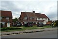
MK43 7RA is primarily an owner-occupied area, with 83% of residents living in their own homes. The accommodation type is predominantly houses, which suggests a focus on family-friendly living rather than rental-focused developments. This composition indicates a market where property values are likely to be stable, as owner-occupiers tend to hold onto homes for longer periods. For buyers, this means a limited selection of available properties, as the area’s small size and high home ownership rate reduce turnover. The absence of flats or apartments also means the housing stock is less suited to younger buyers or those seeking short-term rentals. Those considering the area should expect a slower-moving market, with opportunities more likely to arise through inheritance or long-term residents moving out rather than new developments.
House Prices in MK43 7RA
No properties found in this postcode.
Energy Efficiency in MK43 7RA
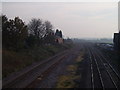
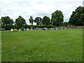
MK43 7RA’s lifestyle is shaped by its proximity to retail and transport hubs. Nearby amenities include five retail outlets, such as Budgens Clapham, Tesco Clapham, and The Southern Co-operative Co, providing residents with everyday shopping convenience. The three nearby railway stations—Bedford, Bedford St Johns, and Kempston Hardwick—offer easy access to broader regional networks, supporting both daily commutes and weekend excursions. While the area lacks large parks or leisure facilities, its compact design ensures residents can reach essential services without long journeys. The mix of retail and transport options contributes to a practical, low-maintenance lifestyle, ideal for those prioritising accessibility over expansive recreational spaces.
Amenities
Schools
Residents of MK43 7RA have access to a range of educational institutions, including primary schools such as Oakley Lower School, Lincroft Middle School, and Oakley Primary Academy, all of which hold Ofsted ratings of ‘good’. Lincroft Academy, a secondary school, also has a ‘good’ rating, providing families with a continuum of education options. The presence of both primary and academy schools suggests a diverse educational landscape, with opportunities for both traditional state schooling and academically focused institutions. For parents, this mix ensures flexibility in choosing schools that align with their children’s needs, whether prioritising established local schools or academies with specific curricula. The proximity of these schools to the area reinforces its appeal for families seeking a stable, education-focused environment.
| Rank | School | Type | Entry gender | Ages |
|---|
Explore more schools in this area
Go to Schools tabDemographics
MK43 7RA’s population is predominantly composed of adults aged 30–64, reflecting a mature demographic with a median age of 47. Home ownership is high, with 83% of residents living in owner-occupied properties, indicating a stable, long-term community. The area is dominated by houses rather than flats, aligning with the preferences of its older, family-oriented residents. The predominant ethnic group is White, though specific diversity metrics are not provided. This demographic profile suggests a community focused on stability, with fewer transient residents. The low deprivation levels, inferred from high home ownership and the absence of environmental constraints, likely contribute to a quality of life that prioritises security and predictability. However, the lack of younger households or diverse age groups may limit the vibrancy of local social scenes compared to more mixed areas.
Household Size
Accommodation Type
Tenure
Ethnic Group
Religion
Household Composition
Age
Household Deprivation
NS-SEC
Explore more demographic insights in this area
Go to Demographics tabPlanning
Planning Constraints
- Flood RiskPremium
- Ramsar Wetland SitesPremium
- Area of Outstanding Natural BeautyPremium
- Protected Nature ReservePremium
- Protected WoodlandPremium