Area Overview for MK43 7QU
Photos of MK43 7QU
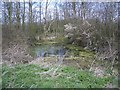


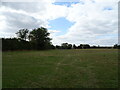
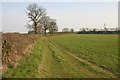
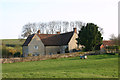
7 photos from this area
Area Information
Key information about the MK43 7QU including its size, population, and administrative classification.
- Area Type
- Postcode
- Area Size
- 1.7 km²
- Population
- 1508
- Population Density
- 97 people/km²
House Prices in MK43 7QU
24
Properties
£404,542
Average Sold Price
£114,000
Lowest Price
£1,100,000
Highest Price
Showing 24 properties
| Address | Type | Beds | Baths | Last Sale Price | Last Sale Date | |
|---|---|---|---|---|---|---|
| 16 West End, Stevington, MK43 7QU | Terraced | 4 | 2 | £475,000 | Aug 2023 | |
| West End Farm, West End, Stevington, MK43 7QU | Detached | 4 | - | £1,100,000 | Dec 2021 | |
| 26 West End, Stevington, MK43 7QU | house | - | - | £256,000 | Jul 2020 | |
| Middle Farm, West End, Stevington, MK43 7QU | Detached | 4 | - | £720,000 | Jul 2019 | |
| Cornerway, 24 West End, Stevington, MK43 7QU | house | - | - | £350,000 | Jul 2017 | |
| 18 West End, Stevington, MK43 7QU | Semi-detached | 2 | 1 | £242,500 | Aug 2016 | |
| 14 West End, Stevington, MK43 7QU | Terraced | 3 | 1 | £225,000 | Jun 2015 | |
| Pyghtle, West End, Stevington, MK43 7QU | house | - | - | £450,000 | May 2009 | |
| Honeystone, 22A West End, Stevington, MK43 7QU | house | - | - | £395,000 | Apr 2005 | |
| The Dell, West End, Stevington, MK43 7QU | Detached | - | - | £375,000 | Oct 2003 |
Page 1 of 3
Energy Efficiency in MK43 7QU
Amenities
Schools
| Rank | School | Type | Entry gender | Ages |
|---|
Explore more schools in this area
Go to Schools tabDemographics
Household Size
Two person
most common
Accommodation Type
Houses
most common
Tenure
81
majority
Ethnic Group
White
most common
Religion
N/A
most common
Household Composition
N/A
most common
Age
47
median
Adults (30-64 years)
most common
Household Deprivation
N/A
with no deprivation
NS-SEC
45
in Lower managerial occupations
Explore more demographic insights in this area
Go to Demographics tabPlanning
Planning Constraints
- Flood RiskPremium
- Ramsar Wetland SitesPremium
- Area of Outstanding Natural BeautyPremium
- Protected Nature ReservePremium
- Protected WoodlandPremium