Area Overview for MK43 7HD
Photos of MK43 7HD
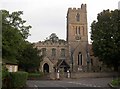

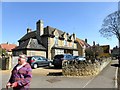

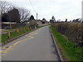

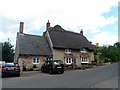
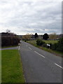


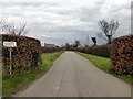
60 photos from this area
Area Information
Key information about the MK43 7HD including its size, population, and administrative classification.
- Area Type
- Postcode
- Area Size
- 2.6 hectares
- Population
- 1405
- Population Density
- 103 people/km²
House Prices in MK43 7HD
41
Properties
£269,135
Average Sold Price
£84,000
Lowest Price
£700,000
Highest Price
Showing 41 properties
| Address | Type | Beds | Baths | Last Sale Price | Last Sale Date | |
|---|---|---|---|---|---|---|
| 10 Marriotts Close, Felmersham, MK43 7HD | Semi-detached | 4 | 1 | £445,000 | Apr 2025 | |
| 23 Marriotts Close, Felmersham, MK43 7HD | Retail | 4 | 2 | £700,000 | Jul 2022 | |
| 36 Marriotts Close, Felmersham, MK43 7HD | Detached | 3 | - | £395,000 | Jun 2021 | |
| 19 Marriotts Close, Felmersham, MK43 7HD | house | - | - | £385,000 | Oct 2020 | |
| 44 Marriotts Close, Felmersham, MK43 7HD | Bungalow | - | - | £265,000 | Oct 2020 | |
| 52 Marriotts Close, Felmersham, MK43 7HD | Detached | 3 | 1 | £315,000 | May 2020 | |
| 48 Marriotts Close, Felmersham, MK43 7HD | Bungalow | - | - | £269,000 | Mar 2018 | |
| 7 Marriotts Close, Felmersham, MK43 7HD | Detached | 4 | - | £310,000 | Feb 2018 | |
| 2 Marriotts Close, Felmersham, MK43 7HD | Detached | 4 | 2 | £381,000 | Dec 2017 | |
| 21 Marriotts Close, Felmersham, MK43 7HD | Detached | 4 | 3 | £355,000 | Oct 2015 |
Page 1 of 5
Energy Efficiency in MK43 7HD
Amenities
Schools
| Rank | School | Type | Entry gender | Ages |
|---|
Explore more schools in this area
Go to Schools tabDemographics
Household Size
Two person
most common
Accommodation Type
Houses
most common
Tenure
85
majority
Ethnic Group
White
most common
Religion
N/A
most common
Household Composition
N/A
most common
Age
47
median
Adults (30-64 years)
most common
Household Deprivation
N/A
with no deprivation
NS-SEC
50
in Lower managerial occupations
Explore more demographic insights in this area
Go to Demographics tabPlanning
Planning Constraints
- Flood RiskPremium
- Ramsar Wetland SitesPremium
- Area of Outstanding Natural BeautyPremium
- Protected Nature ReservePremium
- Protected WoodlandPremium