Area Overview for MK43 7BJ
Photos of MK43 7BJ
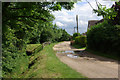
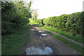
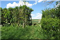
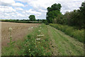
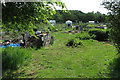
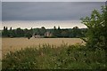
6 photos from this area
Area Information
Key information about the MK43 7BJ including its size, population, and administrative classification.
- Area Type
- Postcode
- Area Size
- 8.5 hectares
- Population
- 1949
- Population Density
- 78 people/km²
House Prices in MK43 7BJ
21
Properties
£333,900
Average Sold Price
£120,000
Lowest Price
£785,000
Highest Price
Showing 21 properties
| Address | Type | Beds | Baths | Last Sale Price | Last Sale Date | |
|---|---|---|---|---|---|---|
| 85 High Street, Harrold, MK43 7BJ | house | 5 | - | £785,000 | Dec 2022 | |
| 77 High Street, Harrold, MK43 7BJ | house | - | - | £365,000 | Jun 2021 | |
| 114A High Street, Harrold, MK43 7BJ | Detached | 4 | 2 | £380,000 | Nov 2020 | |
| 73 High Street, Harrold, MK43 7BJ | house | 3 | 1 | £144,000 | Aug 2019 | |
| 116 High Street, Harrold, MK43 7BJ | Detached | 4 | 2 | £445,000 | Aug 2017 | |
| 87 High Street, Harrold, MK43 7BJ | Detached | 4 | - | £420,000 | Nov 2014 | |
| 79 High Street, Harrold, MK43 7BJ | Cottage | 3 | 1 | £250,000 | Sep 2014 | |
| Eagle Works, 75 High Street, Harrold, MK43 7BJ | Terraced | 2 | - | £165,000 | Sep 2014 | |
| 124 High Street, Harrold, MK43 7BJ | house | - | - | £265,000 | Dec 2009 | |
| The Vines, 114 High Street, Harrold, MK43 7BJ | Detached | - | - | £120,000 | Oct 1997 |
Page 1 of 3
Energy Efficiency in MK43 7BJ
Amenities
Schools
| Rank | School | Type | Entry gender | Ages |
|---|
Explore more schools in this area
Go to Schools tabDemographics
Household Size
Two person
most common
Accommodation Type
Houses
most common
Tenure
72
majority
Ethnic Group
White
most common
Religion
N/A
most common
Household Composition
N/A
most common
Age
47
median
Adults (30-64 years)
most common
Household Deprivation
N/A
with no deprivation
NS-SEC
49
in Lower managerial occupations
Explore more demographic insights in this area
Go to Demographics tabPlanning
Planning Constraints
- Flood RiskPremium
- Ramsar Wetland SitesPremium
- Area of Outstanding Natural BeautyPremium
- Protected Nature ReservePremium
- Protected WoodlandPremium