Area Overview for MK43 7AP
Photos of MK43 7AP

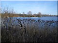
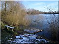
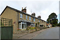

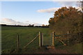
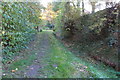
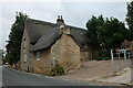
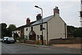

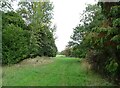
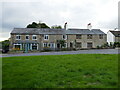
16 photos from this area
Area Information
Key information about the MK43 7AP including its size, population, and administrative classification.
- Area Type
- Postcode
- Area Size
- 92.7 hectares
- Population
- 1949
- Population Density
- 78 people/km²
House Prices in MK43 7AP
28
Properties
£389,143
Average Sold Price
£35,000
Lowest Price
£910,000
Highest Price
Showing 28 properties
| Address | Type | Beds | Baths | Last Sale Price | Last Sale Date | |
|---|---|---|---|---|---|---|
| 121 Odell Road, Odell, MK43 7AP | Terraced | 2 | 1 | £910,000 | Mar 2025 | |
| 85 Odell Road, Odell, MK43 7AP | Terraced | 2 | 1 | £260,000 | Sep 2024 | |
| 81 Odell Road, Odell, MK43 7AP | Terraced | 2 | 1 | £305,000 | Apr 2023 | |
| 83 Odell Road, Odell, MK43 7AP | house | - | - | £432,500 | Mar 2022 | |
| 73 Odell Road, Odell, MK43 7AP | house | - | - | £230,000 | Dec 2020 | |
| 89 Odell Road, Odell, MK43 7AP | house | - | - | £465,000 | Aug 2020 | |
| 77 Odell Road, Odell, MK43 7AP | house | 2 | - | £213,000 | Sep 2018 | |
| 69 Odell Road, Odell, MK43 7AP | house | - | - | £277,500 | Sep 2018 | |
| 79 Odell Road, Odell, MK43 7AP | house | 2 | 1 | £260,000 | Aug 2018 | |
| 91 Odell Road, Odell, MK43 7AP | Detached | 5 | 3 | £700,000 | Mar 2017 |
Page 1 of 3
Energy Efficiency in MK43 7AP
Amenities
Schools
| Rank | School | Type | Entry gender | Ages |
|---|
Explore more schools in this area
Go to Schools tabDemographics
Household Size
Two person
most common
Accommodation Type
Houses
most common
Tenure
72
majority
Ethnic Group
White
most common
Religion
N/A
most common
Household Composition
N/A
most common
Age
47
median
Adults (30-64 years)
most common
Household Deprivation
N/A
with no deprivation
NS-SEC
49
in Lower managerial occupations
Explore more demographic insights in this area
Go to Demographics tabPlanning
Planning Constraints
- Flood RiskPremium
- Ramsar Wetland SitesPremium
- Area of Outstanding Natural BeautyPremium
- Protected Nature ReservePremium
- Protected WoodlandPremium