Area Overview for MK43 0ZZ
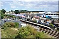
Photos of MK43 0ZZ


Area Information
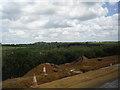
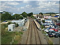
MK43 0ZZ is a small, tightly knit residential postcode in England, home to 1,885 people spread across a low-density area of 18.7 km². This cluster of homes, characterised by a median age of 22, reflects a community dominated by young adults, many of whom may be students or early-career professionals. The area’s compact size fosters a localised feel, with amenities and services within practical reach. Its proximity to Cranfield University, a major educational institution, suggests a link to academic and research environments. Daily life here is shaped by the balance between residential tranquillity and access to transport networks, with five nearby rail stations offering connections to larger towns. While the area lacks major urban infrastructure, its small-scale nature ensures a quieter, more personal living experience. For buyers, MK43 0ZZ presents an opportunity to own a home in a low-risk, low-crime environment, though its limited size means the surrounding areas may need to be considered for broader lifestyle needs.
- Area Type
- Postcode
- Area Size
- Not available
- Population
- 1885
- Population Density
- 101 people/km²
MK43 0ZZ is primarily an owner-occupied area, with 63% of residents owning their homes. The accommodation type is predominantly houses, which is unusual for a small postcode but may reflect a mix of family homes and properties rented out by owners. This suggests a market where property ownership is common, though the limited size of the area means the housing stock is not extensive. Buyers should consider that the immediate surroundings may hold more options, as the postcode itself contains only a small cluster of homes. The presence of houses rather than flats indicates a preference for larger, standalone properties, which may appeal to those seeking space or investment potential. However, the small scale of the area means that property availability is likely limited, requiring buyers to look beyond MK43 0ZZ for more options.
House Prices in MK43 0ZZ
No properties found in this postcode.
Energy Efficiency in MK43 0ZZ
MK43 0ZZ offers access to essential retail amenities, with Sainsburys in Wavendon, Co-op in Woburn, and Tesco in Woburn within practical reach. These stores provide everyday shopping convenience, reducing the need for long journeys to larger centres. The area’s rail stations also connect residents to broader leisure and employment opportunities. However, there is no data on parks, dining, or recreational facilities, meaning the lifestyle options are likely limited to what is immediately available. The presence of retail and transport hubs suggests a functional, if minimalist, daily life. For those prioritising convenience over extensive leisure options, the area’s proximity to shops and transport may be a key advantage.
Amenities
Schools
The only notable educational institution near MK43 0ZZ is Cranfield University, a postgraduate and research-focused institution. While it is not a school in the traditional sense, it may serve students and professionals in the area. Families seeking primary or secondary education will find no schools listed in the data, meaning they would need to look further afield. This absence of local schools could be a consideration for buyers with children, as it may increase commuting times or necessitate reliance on nearby towns. The lack of traditional schools contrasts with the presence of a university, suggesting the area is more suited to those without immediate schooling needs or those working in higher education.
| Rank | School | Type | Entry gender | Ages |
|---|
Explore more schools in this area
Go to Schools tabDemographics
The population of MK43 0ZZ is predominantly young, with a median age of 22 and 63% of residents owning their homes. This suggests a demographic skewed towards early-career individuals, many of whom may be students or professionals working in nearby sectors. The area’s accommodation is largely composed of houses, reflecting a preference for standalone properties over flats. The predominant ethnic group is White, with no data provided on other ethnicities. With a population density of 101 people per km², the area is sparsely populated, contributing to a sense of space and privacy. However, this low density also means fewer communal spaces or social hubs. The high home ownership rate indicates stability, though the absence of detailed diversity data limits understanding of the community’s full composition. For buyers, this profile may appeal to those seeking affordability and a quieter, less congested environment.
Household Size
Accommodation Type
Tenure
Ethnic Group
Religion
Household Composition
Age
Household Deprivation
NS-SEC
Explore more demographic insights in this area
Go to Demographics tabPlanning
Planning Constraints
- Flood RiskPremium
- Ramsar Wetland SitesPremium
- Area of Outstanding Natural BeautyPremium
- Protected Nature ReservePremium
- Protected WoodlandPremium