Area Overview for MK43 0XB
Photos of MK43 0XB
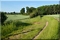
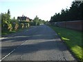
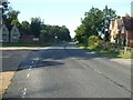
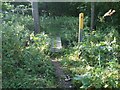
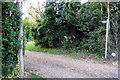
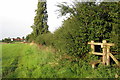
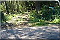
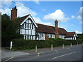
17 photos from this area
Area Information
Key information about the MK43 0XB including its size, population, and administrative classification.
- Area Type
- Postcode
- Area Size
- 1.2 km²
- Population
- 1193
- Population Density
- 126 people/km²
House Prices in MK43 0XB
44
Properties
£227,285
Average Sold Price
£60,000
Lowest Price
£450,000
Highest Price
Showing 44 properties
| Address | Type | Beds | Baths | Last Sale Price | Last Sale Date | |
|---|---|---|---|---|---|---|
| 19 Turnpike Road, Husborne Crawley, MK43 0XB | house | - | - | £450,000 | Dec 2022 | |
| 24 Turnpike Road, Husborne Crawley, MK43 0XB | Terraced | 2 | 2 | £421,500 | Nov 2021 | |
| 40-41 Turnpike Road, Husborne Crawley, MK43 0XB | house | - | - | £350,000 | May 2019 | |
| 42 Turnpike Road, Husborne Crawley, MK43 0XB | Terraced | - | - | £275,000 | Feb 2019 | |
| 17 Turnpike Road, Husborne Crawley, MK43 0XB | Terraced | 2 | - | £310,000 | Nov 2017 | |
| 42-43 Turnpike Road, Husborne Crawley, MK43 0XB | Terraced | - | - | £295,000 | Dec 2015 | |
| 45 Turnpike Road, Husborne Crawley, MK43 0XB | Cottage | 3 | 1 | £295,000 | Mar 2012 | |
| St Brigids Cottage, 36 Turnpike Road, Husborne Crawley, MK43 0XB | Terraced | - | - | £170,000 | Aug 2006 | |
| 22 Turnpike Road, Husborne Crawley, MK43 0XB | Terraced | - | - | £182,000 | Sep 2002 | |
| 27 Turnpike Road, Husborne Crawley, MK43 0XB | Terraced | - | - | £117,000 | Jul 2002 |
Page 1 of 5
Energy Efficiency in MK43 0XB
Amenities
Schools
| Rank | School | Type | Entry gender | Ages |
|---|
Explore more schools in this area
Go to Schools tabDemographics
Household Size
Two person
most common
Accommodation Type
Houses
most common
Tenure
60
majority
Ethnic Group
White
most common
Religion
N/A
most common
Household Composition
N/A
most common
Age
47
median
Adults (30-64 years)
most common
Household Deprivation
N/A
with no deprivation
NS-SEC
40
in Lower managerial occupations
Explore more demographic insights in this area
Go to Demographics tabPlanning
Planning Constraints
- Flood RiskPremium
- Ramsar Wetland SitesPremium
- Area of Outstanding Natural BeautyPremium
- Protected Nature ReservePremium
- Protected WoodlandPremium