Area Overview for MK43 0DP
Photos of MK43 0DP

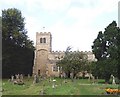
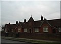
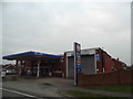
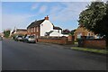
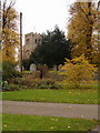
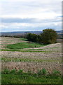
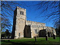
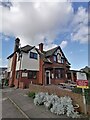
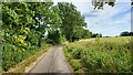
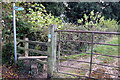
13 photos from this area
Area Information
Key information about the MK43 0DP including its size, population, and administrative classification.
- Area Type
- Postcode
- Area Size
- 3.4 hectares
- Population
- 1778
- Population Density
- 1305 people/km²
House Prices in MK43 0DP
29
Properties
£301,045
Average Sold Price
£160,000
Lowest Price
£640,000
Highest Price
Showing 29 properties
| Address | Type | Beds | Baths | Last Sale Price | Last Sale Date | |
|---|---|---|---|---|---|---|
| 79 High Street, Cranfield, MK43 0DP | Terraced | 3 | 1 | £305,000 | Jun 2025 | |
| 47 High Street, Cranfield, MK43 0DP | Semi-detached | 3 | 1 | £430,000 | Nov 2023 | |
| 43 High Street, Cranfield, MK43 0DP | Detached | 4 | 2 | £640,000 | Apr 2023 | |
| 81 High Street, Cranfield, MK43 0DP | Terraced | 4 | 1 | £338,000 | Dec 2022 | |
| 37 High Street, Cranfield, MK43 0DP | Cottage | 2 | 1 | £230,000 | Nov 2020 | |
| 35 High Street, Cranfield, MK43 0DP | Terraced | 2 | 1 | £218,500 | Aug 2015 | |
| 39 High Street, Cranfield, MK43 0DP | Terraced | 2 | 1 | £210,000 | Feb 2015 | |
| 49 High Street, Cranfield, MK43 0DP | Semi-detached | 3 | 1 | £200,000 | Dec 2014 | |
| 41A High Street, Cranfield, MK43 0DP | house | - | - | £235,000 | Oct 2009 | |
| 91 High Street, Cranfield, MK43 0DP | Detached | 5 | - | £345,000 | Dec 2002 |
Page 1 of 3
Energy Efficiency in MK43 0DP
Amenities
Schools
| Rank | School | Type | Entry gender | Ages |
|---|
Explore more schools in this area
Go to Schools tabDemographics
Household Size
Family (3-5 people)
most common
Accommodation Type
Houses
most common
Tenure
74
majority
Ethnic Group
White
most common
Religion
N/A
most common
Household Composition
N/A
most common
Age
47
median
Adults (30-64 years)
most common
Household Deprivation
N/A
with no deprivation
NS-SEC
42
in Lower managerial occupations
Explore more demographic insights in this area
Go to Demographics tabPlanning
Planning Constraints
- Flood RiskPremium
- Ramsar Wetland SitesPremium
- Area of Outstanding Natural BeautyPremium
- Protected Nature ReservePremium
- Protected WoodlandPremium