Area Overview for MK43 0AA
Photos of MK43 0AA
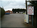
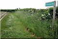
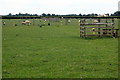
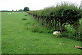
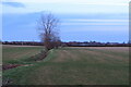
11 photos from this area
Area Information
Key information about the MK43 0AA including its size, population, and administrative classification.
- Area Type
- Postcode
- Area Size
- 25.7 hectares
- Population
- 1364
- Population Density
- 211 people/km²
House Prices in MK43 0AA
24
Properties
£327,708
Average Sold Price
£94,000
Lowest Price
£740,000
Highest Price
Showing 24 properties
| Address | Type | Beds | Baths | Last Sale Price | Last Sale Date | |
|---|---|---|---|---|---|---|
| Really Flexible Care Ltd, Cinnamon Lodge, 27 Crawley Road, Cranfield, MK43 0AA | Retail | 6 | 4 | £740,000 | Jun 2022 | |
| 35 Crawley Road, Cranfield, MK43 0AA | Semi-detached | 2 | 1 | £290,000 | Oct 2020 | |
| 5 Crawley Road, Cranfield, MK43 0AA | house | - | - | £343,000 | Feb 2020 | |
| 31 Crawley Road, Cranfield, MK43 0AA | house | - | - | £400,000 | Sep 2019 | |
| 3 Crawley Road, Cranfield, MK43 0AA | Semi-detached | 3 | 1 | £280,000 | Jul 2019 | |
| 37 Crawley Road, Cranfield, MK43 0AA | Semi-detached | 3 | - | £397,500 | Feb 2018 | |
| 15 Crawley Road, Cranfield, MK43 0AA | Detached | 5 | - | £417,500 | Jun 2016 | |
| 13 Crawley Road, Cranfield, MK43 0AA | Detached | 4 | 3 | £401,000 | Dec 2015 | |
| 9 Crawley Road, Cranfield, MK43 0AA | house | 3 | - | £183,000 | Dec 2009 | |
| 39 Crawley Road, Cranfield, MK43 0AA | Detached | - | - | £208,000 | Feb 2003 |
Page 1 of 3
Energy Efficiency in MK43 0AA
Amenities
Schools
| Rank | School | Type | Entry gender | Ages |
|---|
Explore more schools in this area
Go to Schools tabDemographics
Household Size
Family (3-5 people)
most common
Accommodation Type
Houses
most common
Tenure
76
majority
Ethnic Group
White
most common
Religion
N/A
most common
Household Composition
N/A
most common
Age
47
median
Adults (30-64 years)
most common
Household Deprivation
N/A
with no deprivation
NS-SEC
47
in Lower managerial occupations
Explore more demographic insights in this area
Go to Demographics tabPlanning
Planning Constraints
- Flood RiskPremium
- Ramsar Wetland SitesPremium
- Area of Outstanding Natural BeautyPremium
- Protected Nature ReservePremium
- Protected WoodlandPremium