Area Overview for MK42 9UP
Photos of MK42 9UP
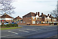
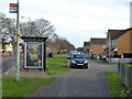
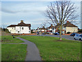
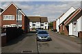
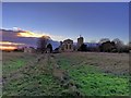
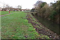
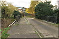
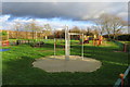
28 photos from this area
Area Information
Key information about the MK42 9UP including its size, population, and administrative classification.
- Area Type
- Postcode
- Area Size
- 4.7 hectares
- Population
- 1525
- Population Density
- 3534 people/km²
House Prices in MK42 9UP
25
Properties
£157,115
Average Sold Price
£34,000
Lowest Price
£298,000
Highest Price
Showing 25 properties
| Address | Type | Beds | Baths | Last Sale Price | Last Sale Date | |
|---|---|---|---|---|---|---|
| 117 Mile Road, Bedford, MK42 9UP | Semi-detached | 3 | 1 | £298,000 | Oct 2024 | |
| 141 Mile Road, Bedford, MK42 9UP | house | - | - | £295,000 | Sep 2023 | |
| 143 Mile Road, Bedford, MK42 9UP | house | - | - | £290,000 | Oct 2021 | |
| 107 Mile Road, Bedford, MK42 9UP | house | - | - | £200,000 | Jul 2016 | |
| 109 Mile Road, Bedford, MK42 9UP | Terraced | 3 | - | £190,000 | Feb 2016 | |
| 131 Mile Road, Bedford, MK42 9UP | house | 3 | - | £120,000 | Dec 2011 | |
| 103 Mile Road, Bedford, MK42 9UP | Terraced | - | - | £158,000 | Oct 2007 | |
| 123 Mile Road, Bedford, MK42 9UP | Terraced | - | - | £128,000 | Aug 2006 | |
| 135 Mile Road, Bedford, MK42 9UP | house | - | - | £131,500 | Dec 2005 | |
| 137 Mile Road, Bedford, MK42 9UP | Terraced | - | - | £80,000 | Apr 2002 |
Page 1 of 3
Energy Efficiency in MK42 9UP
Amenities
Schools
| Rank | School | Type | Entry gender | Ages |
|---|
Explore more schools in this area
Go to Schools tabDemographics
Household Size
Family (3-5 people)
most common
Accommodation Type
Houses
most common
Tenure
69
majority
Ethnic Group
White
most common
Religion
N/A
most common
Household Composition
N/A
most common
Age
47
median
Adults (30-64 years)
most common
Household Deprivation
N/A
with no deprivation
NS-SEC
22
in Lower managerial occupations
Explore more demographic insights in this area
Go to Demographics tabPlanning
Planning Constraints
- Flood RiskPremium
- Ramsar Wetland SitesPremium
- Area of Outstanding Natural BeautyPremium
- Protected Nature ReservePremium
- Protected WoodlandPremium