Area Overview for MK42 9LD
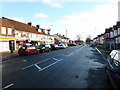
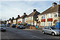
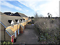
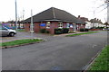
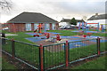
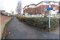
Photos of MK42 9LD


Area Information
Living in MK42 9LD offers a quiet, residential experience within a small cluster of homes. With a population of 2,087, this postcode area is compact yet functional, catering to those seeking a low-key lifestyle. The community is predominantly composed of adults aged 30–64, suggesting a stable demographic with established households. Daily life here is defined by proximity to essential services and transport links. While the area lacks major urban amenities, its strategic placement near Bedford ensures access to broader facilities. The housing stock is largely composed of houses, reflecting a traditional, family-oriented layout. Residents benefit from strong digital connectivity, with broadband scores in the 92–100 range, supporting remote work and online activities. However, the area’s small size means it is not suited for those requiring extensive commercial or cultural offerings. MK42 9LD is ideal for individuals prioritising security, simplicity, and practicality over high-density living.
- Area Type
- Postcode
- Area Size
- Not available
- Population
- 2087
- Population Density
- 4554 people/km²
The property market in MK42 9LD is defined by a 35% home ownership rate, meaning the majority of properties are rented. The accommodation type is predominantly houses, which contrasts with areas where flats or apartments dominate. This suggests a market skewed towards owner-occupied homes, though the lower ownership rate indicates a strong rental presence. The small size of the area means property choices are limited to individual homes rather than larger developments. For buyers, this implies a niche market with limited stock, potentially requiring a focus on nearby areas for more options. The housing stock’s age and layout may appeal to those seeking traditional, low-maintenance properties. However, the lack of data on property prices or recent sales trends means buyers must consider the broader Bedford region for comparative insights.
House Prices in MK42 9LD
No properties found in this postcode.
Energy Efficiency in MK42 9LD
Residents of MK42 9LD have access to a range of local amenities within practical reach. Retail options include Asda Southgate, Spar, and Lidl St, providing essential shopping and convenience services. The presence of five retail outlets suggests a functional, community-focused retail environment. While the data does not mention dining or leisure facilities, the railway stations nearby likely connect residents to Bedford’s broader offerings, including restaurants, parks, and cultural venues. The area’s small size means amenities are concentrated, requiring minimal travel for daily needs. However, those seeking extensive leisure or entertainment options may need to travel to Bedford. The combination of retail access and transport links ensures a lifestyle that balances simplicity with connectivity.
Amenities
Schools
The nearest school to MK42 9LD is Bedford Girls’ School, an independent institution. No other schools are listed in the data, meaning families relying on state education may need to look beyond the immediate area. The presence of a single independent school suggests that the area may cater to households prioritising private education. However, the absence of state schools or additional educational institutions could pose challenges for families seeking a range of options. Parents should consider the distance to Bedford’s state schools, which may be necessary for comprehensive schooling. The school’s type and location highlight a focus on private education, but this does not provide insight into the quality or Ofsted ratings, which are not included in the data.
| Rank | School | Type | Entry gender | Ages |
|---|
Explore more schools in this area
Go to Schools tabDemographics
The community in MK42 9LD is predominantly middle-aged, with a median age of 47 and the most common age group being adults aged 30–64. This suggests a population of settled individuals, likely focused on long-term residency rather than transient living. Home ownership is relatively low at 35%, indicating that a significant portion of residents rent their properties. The area is characterised by houses rather than flats, aligning with a preference for standalone homes. The predominant ethnic group is White, reflecting a homogenous demographic profile. While no specific deprivation data is provided, the low home ownership rate may imply limited economic diversity. The age profile and housing type suggest a community that prioritises stability over rapid change, with a focus on family-oriented living.
Household Size
Accommodation Type
Tenure
Ethnic Group
Religion
Household Composition
Age
Household Deprivation
NS-SEC
Explore more demographic insights in this area
Go to Demographics tabPlanning
Planning Constraints
- Flood RiskPremium
- Ramsar Wetland SitesPremium
- Area of Outstanding Natural BeautyPremium
- Protected Nature ReservePremium
- Protected WoodlandPremium