Area Overview for MK42 8UQ
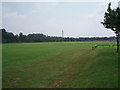
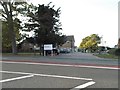
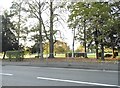
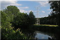
Photos of MK42 8UQ


Area Information
MK42 8UQ is a small residential cluster in England with a population of 1505, reflecting a tight-knit community. The area’s character is defined by its modest size and the presence of local amenities such as retail outlets and rail stations. Residents here are predominantly adults aged 30-64, with a median age of 47, suggesting a mature demographic. The area is primarily composed of houses, with 56% of properties owner-occupied. Living in MK42 8UQ offers proximity to essential services, including schools and supermarkets, while the low flood risk and absence of environmental constraints make it a stable location. Daily life is shaped by practical connectivity, with nearby rail links to Bedford and Kempston, and digital infrastructure rated as excellent for broadband. The area’s appeal lies in its balance of convenience and quiet living, ideal for those seeking a settled environment without urban chaos.
- Area Type
- Postcode
- Area Size
- Not available
- Population
- 1505
- Population Density
- 2466 people/km²
The property market in MK42 8UQ is characterised by a high rate of home ownership, with 56% of properties owner-occupied. This suggests a community of long-term residents rather than a transient rental market. The accommodation type is predominantly houses, which is typical for smaller, residential areas. The limited size of the area means housing stock is constrained, making it a niche market for buyers seeking single-family homes. Proximity to rail stations and retail hubs adds to the appeal, though the small footprint of MK42 8UQ means property choices are limited. Buyers should consider the area’s proximity to schools and transport, which may influence property value and desirability. The lack of high-rise or multi-unit developments reinforces its appeal to those prioritising space and privacy.
House Prices in MK42 8UQ
No properties found in this postcode.
Energy Efficiency in MK42 8UQ
Daily life in MK42 8UQ is shaped by nearby amenities such as Tesco Kempston, Sainsburys Kempston, and Tesco Bedford, offering convenient shopping options. The retail presence ensures residents can access groceries and essentials without long journeys. Rail stations like Bedford St Johns and Kempston Hardwick provide direct links to urban centres, enhancing connectivity. While the area lacks detailed information on parks or leisure facilities, the proximity to Bedford suggests access to broader recreational opportunities. The lifestyle here is practical, with a focus on convenience and accessibility. The small size of the area means amenities are tightly clustered, making it easy for residents to navigate their daily routines without relying on a car.
Amenities
Schools
Residents of MK42 8UQ have access to several schools, including Grange School, St John’s School, and Grange Academy, all of which are special schools. These institutions cater to students with specific educational needs, indicating a focus on tailored learning environments. The presence of multiple special schools suggests the area may attract families requiring such provisions. However, the data does not include Ofsted ratings or academic performance metrics, so prospective parents must investigate further. The concentration of special schools reflects the community’s needs but may limit options for those seeking mainstream education. Families should consider whether these schools align with their child’s requirements, as the area lacks information on state or grammar school alternatives.
| Rank | School | Type | Entry gender | Ages |
|---|
Explore more schools in this area
Go to Schools tabDemographics
The community in MK42 8UQ is predominantly composed of adults aged 30-64, with a median age of 47. Home ownership stands at 56%, indicating a stable residential base. The area is largely made up of houses, reflecting a traditional housing stock. The predominant ethnic group is White, with no specific data provided on other demographics. The absence of detailed diversity metrics suggests a relatively homogenous population. The age profile implies a community focused on established families and professionals, with limited representation of younger or older age groups. This demographic structure influences local services and amenities, which cater to middle-aged residents. The lack of specific data on deprivation means quality of life factors such as access to healthcare or leisure are not quantified here.
Household Size
Accommodation Type
Tenure
Ethnic Group
Religion
Household Composition
Age
Household Deprivation
NS-SEC
Explore more demographic insights in this area
Go to Demographics tabPlanning
Planning Constraints
- Flood RiskPremium
- Ramsar Wetland SitesPremium
- Area of Outstanding Natural BeautyPremium
- Protected Nature ReservePremium
- Protected WoodlandPremium