Area Overview for MK42 8TJ
Photos of MK42 8TJ


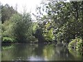
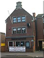
19 photos from this area
Area Information
Key information about the MK42 8TJ including its size, population, and administrative classification.
- Area Type
- Postcode
- Area Size
- 2.0 hectares
- Population
- 1505
- Population Density
- 2466 people/km²
House Prices in MK42 8TJ
22
Properties
£223,422
Average Sold Price
£78,000
Lowest Price
£395,000
Highest Price
Showing 22 properties
| Address | Type | Beds | Baths | Last Sale Price | Last Sale Date | |
|---|---|---|---|---|---|---|
| 19 Prentice Gardens, Kempston, MK42 8TJ | Detached | 4 | 1 | £395,000 | Jan 2022 | |
| 6 Prentice Gardens, Kempston, MK42 8TJ | Detached | 4 | 1 | £387,500 | Aug 2020 | |
| 18 Prentice Gardens, Kempston, MK42 8TJ | house | 4 | - | £335,000 | Mar 2018 | |
| 16 Prentice Gardens, Kempston, MK42 8TJ | Detached | 3 | 1 | £279,995 | Dec 2015 | |
| 4 Prentice Gardens, Kempston, MK42 8TJ | Detached | 4 | 2 | £275,000 | Sep 2014 | |
| 14 Prentice Gardens, Kempston, MK42 8TJ | Detached | - | - | £249,995 | Jun 2012 | |
| 24 Prentice Gardens, Kempston, MK42 8TJ | Detached | - | - | £234,995 | Jul 2007 | |
| 12 Prentice Gardens, Kempston, MK42 8TJ | Detached | 4 | 1 | £175,000 | Aug 2004 | |
| 22 Prentice Gardens, Kempston, MK42 8TJ | Detached | - | - | £99,995 | May 2000 | |
| 10 Prentice Gardens, Kempston, MK42 8TJ | Detached | - | - | £107,000 | Jul 1999 |
Page 1 of 3
Energy Efficiency in MK42 8TJ
Amenities
Schools
| Rank | School | Type | Entry gender | Ages |
|---|
Explore more schools in this area
Go to Schools tabDemographics
Household Size
Family (3-5 people)
most common
Accommodation Type
Houses
most common
Tenure
56
majority
Ethnic Group
White
most common
Religion
N/A
most common
Household Composition
N/A
most common
Age
47
median
Adults (30-64 years)
most common
Household Deprivation
N/A
with no deprivation
NS-SEC
27
in Lower managerial occupations
Explore more demographic insights in this area
Go to Demographics tabPlanning
Planning Constraints
- Flood RiskPremium
- Ramsar Wetland SitesPremium
- Area of Outstanding Natural BeautyPremium
- Protected Nature ReservePremium
- Protected WoodlandPremium