Area Overview for MK42 7TS
Photos of MK42 7TS
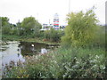
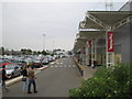
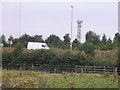
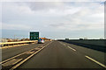
21 photos from this area
Area Information
Key information about the MK42 7TS including its size, population, and administrative classification.
- Area Type
- Postcode
- Area Size
- 7095 m²
- Population
- 1568
- Population Density
- 3316 people/km²
House Prices in MK42 7TS
24
Properties
£201,498
Average Sold Price
£33,450
Lowest Price
£367,000
Highest Price
Showing 24 properties
| Address | Type | Beds | Baths | Last Sale Price | Last Sale Date | |
|---|---|---|---|---|---|---|
| 46 The Silver Birches, Kempston, MK42 7TS | Detached | 4 | 1 | £367,000 | Apr 2024 | |
| 26 The Silver Birches, Kempston, MK42 7TS | Detached | 4 | 1 | £306,000 | Jan 2024 | |
| 4 The Silver Birches, Kempston, MK42 7TS | Terraced | 2 | 1 | £240,000 | Apr 2023 | |
| 32 The Silver Birches, Kempston, MK42 7TS | Bungalow | - | - | £260,000 | Dec 2022 | |
| 48 The Silver Birches, Kempston, MK42 7TS | Detached | 4 | 2 | £322,500 | Sep 2020 | |
| 24 The Silver Birches, Kempston, MK42 7TS | Detached | 4 | 2 | £310,000 | Jan 2020 | |
| 10 The Silver Birches, Kempston, MK42 7TS | Semi-detached | 3 | 2 | £256,000 | Aug 2018 | |
| 14 The Silver Birches, Kempston, MK42 7TS | Detached | 4 | - | £230,000 | Jun 2015 | |
| 20 The Silver Birches, Kempston, MK42 7TS | Detached | 3 | - | £190,000 | Dec 2013 | |
| 6 The Silver Birches, Kempston, MK42 7TS | Terraced | 3 | 1 | £168,000 | Nov 2013 |
Page 1 of 3
Energy Efficiency in MK42 7TS
Amenities
Schools
| Rank | School | Type | Entry gender | Ages |
|---|
Explore more schools in this area
Go to Schools tabDemographics
Household Size
Family (3-5 people)
most common
Accommodation Type
Houses
most common
Tenure
82
majority
Ethnic Group
White
most common
Religion
N/A
most common
Household Composition
N/A
most common
Age
47
median
Adults (30-64 years)
most common
Household Deprivation
N/A
with no deprivation
NS-SEC
31
in Lower managerial occupations
Explore more demographic insights in this area
Go to Demographics tabPlanning
Planning Constraints
- Flood RiskPremium
- Ramsar Wetland SitesPremium
- Area of Outstanding Natural BeautyPremium
- Protected Nature ReservePremium
- Protected WoodlandPremium