Area Overview for MK42 6EH
Photos of MK42 6EH
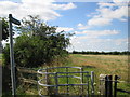
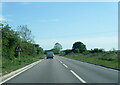
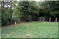
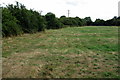

6 photos from this area
Area Information
Key information about the MK42 6EH including its size, population, and administrative classification.
- Area Type
- Postcode
- Area Size
- 1.5 hectares
- Population
- 2037
- Population Density
- 2389 people/km²
House Prices in MK42 6EH
56
Properties
£321,261
Average Sold Price
£175,000
Lowest Price
£394,995
Highest Price
Showing 56 properties
| Address | Type | Beds | Baths | Last Sale Price | Last Sale Date | |
|---|---|---|---|---|---|---|
| 50 Harlequin Crescent, Wixams, MK42 6EH | Semi-detached | 3 | 3 | £335,000 | Sep 2025 | |
| 44 Harlequin Crescent, Wixams, MK42 6EH | house | - | - | £175,000 | May 2025 | |
| 10 Harlequin Crescent, Wixams, MK42 6EH | house | - | - | £330,000 | Mar 2025 | |
| 48 Harlequin Crescent, Wixams, MK42 6EH | house | - | - | £350,000 | Oct 2024 | |
| 98 Harlequin Crescent, Wixams, MK42 6EH | Detached | 2 | 1 | £291,500 | Jul 2023 | |
| 100 Harlequin Crescent, Wixams, MK42 6EH | Semi-detached | 3 | 2 | £355,500 | May 2023 | |
| 108 Harlequin Crescent, Wixams, MK42 6EH | house | - | - | £309,696 | Mar 2023 | |
| 104 Harlequin Crescent, Wixams, MK42 6EH | house | - | - | £394,995 | Jan 2023 | |
| 68 Harlequin Crescent, Wixams, MK42 6EH | Semi-detached | 4 | 3 | £385,000 | Dec 2022 | |
| 64 Harlequin Crescent, Wixams, MK42 6EH | house | - | - | £380,000 | Sep 2022 |
Page 1 of 6
Energy Efficiency in MK42 6EH
Amenities
Schools
| Rank | School | Type | Entry gender | Ages |
|---|
Explore more schools in this area
Go to Schools tabDemographics
Household Size
Family (3-5 people)
most common
Accommodation Type
Houses
most common
Tenure
79
majority
Ethnic Group
White
most common
Religion
N/A
most common
Household Composition
N/A
most common
Age
47
median
Adults (30-64 years)
most common
Household Deprivation
N/A
with no deprivation
NS-SEC
46
in Lower managerial occupations
Explore more demographic insights in this area
Go to Demographics tabPlanning
Planning Constraints
- Flood RiskPremium
- Ramsar Wetland SitesPremium
- Area of Outstanding Natural BeautyPremium
- Protected Nature ReservePremium
- Protected WoodlandPremium