Area Overview for MK42 0LB
Photos of MK42 0LB
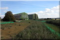
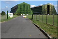
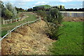
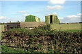
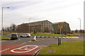
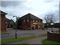

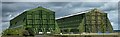
15 photos from this area
Area Information
Key information about the MK42 0LB including its size, population, and administrative classification.
- Area Type
- Postcode
- Area Size
- 1.6 hectares
- Population
- 1402
- Population Density
- 890 people/km²
House Prices in MK42 0LB
32
Properties
£301,685
Average Sold Price
£235,000
Lowest Price
£379,995
Highest Price
Showing 32 properties
| Address | Type | Beds | Baths | Last Sale Price | Last Sale Date | |
|---|---|---|---|---|---|---|
| 54 Hastings Crescent, Shortstown, MK42 0LB | Semi-detached | 2 | 1 | £295,000 | Nov 2025 | |
| 45 Hastings Crescent, Shortstown, MK42 0LB | Terraced | 3 | 2 | £325,000 | Oct 2024 | |
| 37 Hastings Crescent, Shortstown, MK42 0LB | Detached | 2 | 1 | £255,000 | Aug 2023 | |
| 33 Hastings Crescent, Shortstown, MK42 0LB | house | - | - | £345,000 | Mar 2023 | |
| 38 Hastings Crescent, Shortstown, MK42 0LB | Semi-detached | 3 | 1 | £355,000 | Sep 2022 | |
| Rosebok House, 9 Hastings Crescent, Shortstown, MK42 0LB | Retail | 3 | 3 | £365,000 | Jul 2022 | |
| 27 Hastings Crescent, Shortstown, MK42 0LB | house | - | - | £335,000 | Feb 2022 | |
| 5 Hastings Crescent, Shortstown, MK42 0LB | house | - | - | £315,000 | Jun 2021 | |
| 50 Hastings Crescent, Shortstown, MK42 0LB | house | - | - | £235,000 | Jun 2021 | |
| 34 Hastings Crescent, Shortstown, MK42 0LB | Detached | 3 | 3 | £293,000 | Oct 2020 |
Page 1 of 4
Energy Efficiency in MK42 0LB
Amenities
Schools
| Rank | School | Type | Entry gender | Ages |
|---|
Explore more schools in this area
Go to Schools tabDemographics
Household Size
Family (3-5 people)
most common
Accommodation Type
Houses
most common
Tenure
86
majority
Ethnic Group
White
most common
Religion
N/A
most common
Household Composition
N/A
most common
Age
47
median
Adults (30-64 years)
most common
Household Deprivation
N/A
with no deprivation
NS-SEC
48
in Lower managerial occupations
Explore more demographic insights in this area
Go to Demographics tabPlanning
Planning Constraints
- Flood RiskPremium
- Ramsar Wetland SitesPremium
- Area of Outstanding Natural BeautyPremium
- Protected Nature ReservePremium
- Protected WoodlandPremium