Area Overview for MK41 9DD
Photos of MK41 9DD
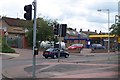
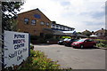
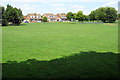
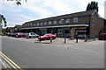
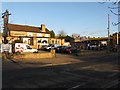
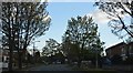
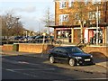
7 photos from this area
Area Information
Key information about the MK41 9DD including its size, population, and administrative classification.
- Area Type
- Postcode
- Area Size
- 7281 m²
- Population
- 1299
- Population Density
- 2841 people/km²
House Prices in MK41 9DD
8
Properties
£193,825
Average Sold Price
£83,950
Lowest Price
£365,000
Highest Price
Showing 8 properties
| Address | Type | Beds | Baths | Last Sale Price | Last Sale Date | |
|---|---|---|---|---|---|---|
| 53 Fairholme, Bedford, MK41 9DD | house | 3 | 1 | £365,000 | Oct 2022 | |
| 61 Fairholme, Bedford, MK41 9DD | Bungalow | 3 | 1 | £260,000 | Aug 2017 | |
| 48 Fairholme, Bedford, MK41 9DD | Bungalow | 3 | 1 | £180,000 | Jan 2015 | |
| 50 Fairholme, Bedford, MK41 9DD | Semi-detached | 2 | - | £170,000 | Oct 2012 | |
| 59 Fairholme, Bedford, MK41 9DD | Detached | 3 | 1 | £104,000 | Nov 1998 | |
| 57 Fairholme, Bedford, MK41 9DD | house | - | - | £83,950 | Oct 1998 | |
| 55 Fairholme, Bedford, MK41 9DD | Semi-detached | 3 | 1 | - | - | |
| 51 Fairholme, Bedford, MK41 9DD | Semi-detached | 2 | 1 | - | - |
Energy Efficiency in MK41 9DD
Amenities
Schools
| Rank | School | Type | Entry gender | Ages |
|---|
Explore more schools in this area
Go to Schools tabDemographics
Household Size
Two person
most common
Accommodation Type
Houses
most common
Tenure
92
majority
Ethnic Group
White
most common
Religion
N/A
most common
Household Composition
N/A
most common
Age
47
median
Adults (30-64 years)
most common
Household Deprivation
N/A
with no deprivation
NS-SEC
46
in Lower managerial occupations
Explore more demographic insights in this area
Go to Demographics tabPlanning
Planning Constraints
- Flood RiskPremium
- Ramsar Wetland SitesPremium
- Area of Outstanding Natural BeautyPremium
- Protected Nature ReservePremium
- Protected WoodlandPremium