Area Overview for MK41 9BP
Photos of MK41 9BP
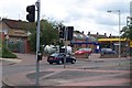
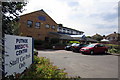
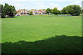
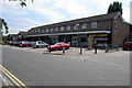
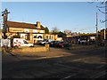
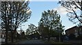
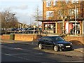
7 photos from this area
Area Information
Key information about the MK41 9BP including its size, population, and administrative classification.
- Area Type
- Postcode
- Area Size
- 9913 m²
- Population
- 1531
- Population Density
- 4451 people/km²
House Prices in MK41 9BP
16
Properties
£215,930
Average Sold Price
£85,000
Lowest Price
£425,000
Highest Price
Showing 16 properties
| Address | Type | Beds | Baths | Last Sale Price | Last Sale Date | |
|---|---|---|---|---|---|---|
| 77 Queens Drive, Bedford, MK41 9BP | house | - | - | £425,000 | Jan 2023 | |
| 73 Queens Drive, Bedford, MK41 9BP | house | - | - | £320,000 | Dec 2020 | |
| 61 Queens Drive, Bedford, MK41 9BP | Detached | 3 | 1 | £380,000 | Jul 2018 | |
| 81 Queens Drive, Bedford, MK41 9BP | house | 3 | - | £236,500 | Nov 2012 | |
| 85 Queens Drive, Bedford, MK41 9BP | Semi-detached | 2 | 1 | £158,000 | Mar 2011 | |
| 75 Queens Drive, Bedford, MK41 9BP | house | - | - | £274,000 | Oct 2010 | |
| 57 Queens Drive, Bedford, MK41 9BP | Detached | 3 | - | £250,000 | Aug 2007 | |
| 67 Queens Drive, Bedford, MK41 9BP | house | 3 | - | £207,500 | Dec 2003 | |
| 55 Queens Drive, Bedford, MK41 9BP | house | 3 | - | £225,000 | May 2003 | |
| 63 Queens Drive, Bedford, MK41 9BP | Semi-detached | - | - | £147,500 | Dec 2001 |
Page 1 of 2
Energy Efficiency in MK41 9BP
Amenities
Schools
| Rank | School | Type | Entry gender | Ages |
|---|
Explore more schools in this area
Go to Schools tabDemographics
Household Size
Two person
most common
Accommodation Type
Houses
most common
Tenure
89
majority
Ethnic Group
White
most common
Religion
N/A
most common
Household Composition
N/A
most common
Age
47
median
Adults (30-64 years)
most common
Household Deprivation
N/A
with no deprivation
NS-SEC
40
in Lower managerial occupations
Explore more demographic insights in this area
Go to Demographics tabPlanning
Planning Constraints
- Flood RiskPremium
- Ramsar Wetland SitesPremium
- Area of Outstanding Natural BeautyPremium
- Protected Nature ReservePremium
- Protected WoodlandPremium