Area Overview for MK41 8AD
Photos of MK41 8AD
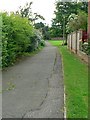
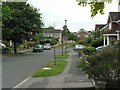
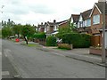
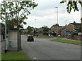

30 photos from this area
Area Information
Key information about the MK41 8AD including its size, population, and administrative classification.
- Area Type
- Postcode
- Area Size
- 1.4 hectares
- Population
- 1456
- Population Density
- 4075 people/km²
House Prices in MK41 8AD
14
Properties
£384,500
Average Sold Price
£120,000
Lowest Price
£837,000
Highest Price
Showing 14 properties
| Address | Type | Beds | Baths | Last Sale Price | Last Sale Date | |
|---|---|---|---|---|---|---|
| 270 Kimbolton Road, Bedford, MK41 8AD | Semi-detached | 6 | 3 | £605,000 | Jan 2024 | |
| 260 Kimbolton Road, Bedford, MK41 8AD | Detached | 3 | 1 | £617,500 | May 2023 | |
| 276 Kimbolton Road, Bedford, MK41 8AD | Detached | 4 | 4 | £837,000 | Feb 2023 | |
| 266 Kimbolton Road, Bedford, MK41 8AD | Semi-detached | 4 | - | £370,000 | Aug 2014 | |
| 280 Kimbolton Road, Bedford, MK41 8AD | Bungalow | 4 | - | £375,000 | Jun 2013 | |
| 278 Kimbolton Road, Bedford, MK41 8AD | Detached | 4 | 3 | £442,500 | Aug 2011 | |
| 264 Kimbolton Road, Bedford, MK41 8AD | Semi-detached | - | - | £185,000 | Jul 2002 | |
| 254 Kimbolton Road, Bedford, MK41 8AD | Detached | - | - | £140,000 | May 1999 | |
| 258 Kimbolton Road, Bedford, MK41 8AD | Detached | - | - | £153,000 | Jun 1997 | |
| 256 Kimbolton Road, Bedford, MK41 8AD | Detached | 4 | - | £120,000 | Jun 1995 |
Page 1 of 2
Energy Efficiency in MK41 8AD
Amenities
Schools
| Rank | School | Type | Entry gender | Ages |
|---|
Explore more schools in this area
Go to Schools tabDemographics
Household Size
Family (3-5 people)
most common
Accommodation Type
Houses
most common
Tenure
83
majority
Ethnic Group
White
most common
Religion
N/A
most common
Household Composition
N/A
most common
Age
47
median
Adults (30-64 years)
most common
Household Deprivation
N/A
with no deprivation
NS-SEC
38
in Lower managerial occupations
Explore more demographic insights in this area
Go to Demographics tabPlanning
Planning Constraints
- Flood RiskPremium
- Ramsar Wetland SitesPremium
- Area of Outstanding Natural BeautyPremium
- Protected Nature ReservePremium
- Protected WoodlandPremium