Area Overview for MK41 7YL
Photos of MK41 7YL
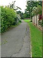
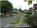
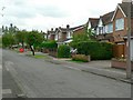
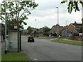

30 photos from this area
Area Information
Key information about the MK41 7YL including its size, population, and administrative classification.
- Area Type
- Postcode
- Area Size
- 7382 m²
- Population
- 1456
- Population Density
- 4075 people/km²
House Prices in MK41 7YL
9
Properties
£222,143
Average Sold Price
£77,000
Lowest Price
£460,000
Highest Price
Showing 9 properties
| Address | Type | Beds | Baths | Last Sale Price | Last Sale Date | |
|---|---|---|---|---|---|---|
| 188 Tyne Crescent, Bedford, MK41 7YL | house | - | - | £365,000 | Feb 2021 | |
| 184 Tyne Crescent, Bedford, MK41 7YL | Detached | 4 | 2 | £460,000 | Feb 2020 | |
| 192 Tyne Crescent, Bedford, MK41 7YL | Detached | 4 | 2 | £362,500 | May 2016 | |
| 186 Tyne Crescent, Bedford, MK41 7YL | Detached | - | - | £125,000 | Aug 1999 | |
| 196 Tyne Crescent, Bedford, MK41 7YL | house | 4 | 2 | £82,500 | May 1997 | |
| 194 Tyne Crescent, Bedford, MK41 7YL | Detached | - | - | £83,000 | Nov 1996 | |
| 190 Tyne Crescent, Bedford, MK41 7YL | Detached | - | - | £77,000 | Oct 1996 | |
| 182 Tyne Crescent, Bedford, MK41 7YL | Detached | 4 | - | - | - | |
| 180 Tyne Crescent, Bedford, MK41 7YL | Detached | - | - | - | - |
Energy Efficiency in MK41 7YL
Amenities
Schools
| Rank | School | Type | Entry gender | Ages |
|---|
Explore more schools in this area
Go to Schools tabDemographics
Household Size
Family (3-5 people)
most common
Accommodation Type
Houses
most common
Tenure
83
majority
Ethnic Group
White
most common
Religion
N/A
most common
Household Composition
N/A
most common
Age
47
median
Adults (30-64 years)
most common
Household Deprivation
N/A
with no deprivation
NS-SEC
38
in Lower managerial occupations
Explore more demographic insights in this area
Go to Demographics tabPlanning
Planning Constraints
- Flood RiskPremium
- Ramsar Wetland SitesPremium
- Area of Outstanding Natural BeautyPremium
- Protected Nature ReservePremium
- Protected WoodlandPremium