Area Overview for MK41 6BB
Photos of MK41 6BB
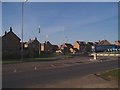
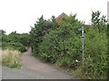
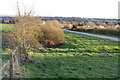
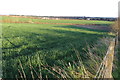
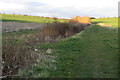
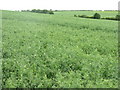
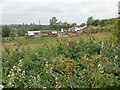
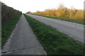
11 photos from this area
Area Information
Key information about the MK41 6BB including its size, population, and administrative classification.
- Area Type
- Postcode
- Area Size
- 1.7 hectares
- Population
- 1963
- Population Density
- 1949 people/km²
House Prices in MK41 6BB
55
Properties
£177,985
Average Sold Price
£49,000
Lowest Price
£318,000
Highest Price
Showing 55 properties
| Address | Type | Beds | Baths | Last Sale Price | Last Sale Date | |
|---|---|---|---|---|---|---|
| 6 Bridle Drive, Clapham, MK41 6BB | Semi-detached | 3 | 1 | £290,000 | Aug 2023 | |
| 32 Bridle Drive, Clapham, MK41 6BB | Semi-detached | 2 | 1 | £312,000 | Apr 2023 | |
| 58 Bridle Drive, Clapham, MK41 6BB | house | 3 | 1 | £266,000 | Mar 2023 | |
| 55 Bridle Drive, Clapham, MK41 6BB | Terraced | 3 | 1 | £265,000 | Sep 2022 | |
| 14 Bridle Drive, Clapham, MK41 6BB | house | - | - | £300,000 | Jan 2022 | |
| 38 Bridle Drive, Clapham, MK41 6BB | Bungalow | 2 | - | £255,000 | Nov 2021 | |
| 2 Bridle Drive, Clapham, MK41 6BB | Bungalow | 3 | 1 | £318,000 | Mar 2021 | |
| 10 Bridle Drive, Clapham, MK41 6BB | house | - | - | £241,500 | Feb 2021 | |
| 47 Bridle Drive, Clapham, MK41 6BB | Terraced | 4 | 2 | £195,000 | Oct 2019 | |
| 49 Bridle Drive, Clapham, MK41 6BB | Terraced | 3 | - | £203,000 | May 2019 |
Page 1 of 6
Energy Efficiency in MK41 6BB
Amenities
Schools
| Rank | School | Type | Entry gender | Ages |
|---|
Explore more schools in this area
Go to Schools tabDemographics
Household Size
Family (3-5 people)
most common
Accommodation Type
Houses
most common
Tenure
74
majority
Ethnic Group
White
most common
Religion
N/A
most common
Household Composition
N/A
most common
Age
47
median
Adults (30-64 years)
most common
Household Deprivation
N/A
with no deprivation
NS-SEC
36
in Lower managerial occupations
Explore more demographic insights in this area
Go to Demographics tabPlanning
Planning Constraints
- Flood RiskPremium
- Ramsar Wetland SitesPremium
- Area of Outstanding Natural BeautyPremium
- Protected Nature ReservePremium
- Protected WoodlandPremium