Area Overview for MK41 0TN
Photos of MK41 0TN

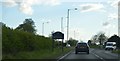

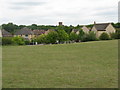


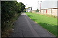
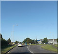

11 photos from this area
Area Information
Key information about the MK41 0TN including its size, population, and administrative classification.
- Area Type
- Postcode
- Area Size
- 2.4 hectares
- Population
- 1648
- Population Density
- 2154 people/km²
House Prices in MK41 0TN
61
Properties
£128,726
Average Sold Price
£29,485
Lowest Price
£250,000
Highest Price
Showing 61 properties
| Address | Type | Beds | Baths | Last Sale Price | Last Sale Date | |
|---|---|---|---|---|---|---|
| 14 Poppyfields, Bedford, MK41 0TN | Detached | 2 | 1 | £218,000 | Mar 2025 | |
| 22 Poppyfields, Bedford, MK41 0TN | Terraced | 2 | 1 | £209,000 | Sep 2023 | |
| 36 Poppyfields, Bedford, MK41 0TN | Terraced | 1 | 1 | £178,000 | Feb 2023 | |
| 30 Poppyfields, Bedford, MK41 0TN | Terraced | 2 | 1 | £210,000 | Jan 2022 | |
| 40 Poppyfields, Bedford, MK41 0TN | house | - | - | £250,000 | Jan 2022 | |
| 94 Poppyfields, Bedford, MK41 0TN | house | - | - | £179,950 | Jun 2021 | |
| 74 Poppyfields, Bedford, MK41 0TN | Terraced | 3 | - | £232,000 | May 2021 | |
| 70 Poppyfields, Bedford, MK41 0TN | house | 2 | - | £195,000 | Oct 2020 | |
| 72 Poppyfields, Bedford, MK41 0TN | Terraced | 2 | 1 | £180,000 | Jun 2020 | |
| 42 Poppyfields, Bedford, MK41 0TN | Terraced | 2 | 1 | £169,000 | Feb 2020 |
Page 1 of 7
Energy Efficiency in MK41 0TN
Amenities
Schools
| Rank | School | Type | Entry gender | Ages |
|---|
Explore more schools in this area
Go to Schools tabDemographics
Household Size
Family (3-5 people)
most common
Accommodation Type
Houses
most common
Tenure
53
majority
Ethnic Group
White
most common
Religion
N/A
most common
Household Composition
N/A
most common
Age
47
median
Adults (30-64 years)
most common
Household Deprivation
N/A
with no deprivation
NS-SEC
30
in Lower managerial occupations
Explore more demographic insights in this area
Go to Demographics tabPlanning
Planning Constraints
- Flood RiskPremium
- Ramsar Wetland SitesPremium
- Area of Outstanding Natural BeautyPremium
- Protected Nature ReservePremium
- Protected WoodlandPremium