Area Overview for MK40 4ZT
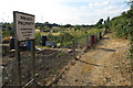
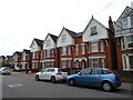
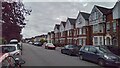
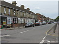
Photos of MK40 4ZT


Area Information
MK40 4ZT is a small, tightly knit residential area in Bedfordshire, England, home to 1,498 people. Its compact size means it offers a quiet, community-focused lifestyle, with homes primarily located in a cluster of properties. The area’s demographic profile suggests a mature population, with a median age of 47 and a majority of residents aged 30–64. This age range indicates a mix of established families and professionals, contributing to a stable, low-traffic environment. Daily life here is characterised by proximity to essential services, with nearby rail links and retail hubs within practical reach. While the area is not large, its small footprint ensures a sense of familiarity and neighbourly interaction. The absence of significant natural or planning constraints means development is limited, preserving the area’s residential charm. For those seeking a peaceful, well-connected home without the hustle of a larger town, MK40 4ZT offers a blend of practicality and quietude.
- Area Type
- Postcode
- Area Size
- Not available
- Population
- 1498
- Population Density
- 3698 people/km²
The property market in MK40 4ZT is defined by a 42% home ownership rate, indicating that nearly half of the area’s homes are owner-occupied, while the remainder are likely rented. The accommodation type is predominantly houses, which suggests a focus on family homes rather than apartments or flats. Given the small population and limited area size, the housing stock is modest, with no indication of high-density development. This makes the area appealing to buyers seeking a quiet, residential environment with a sense of permanence. The predominance of houses may also reflect the community’s demographic profile, where established families are more likely to own property. For prospective buyers, the market is likely to be stable, with limited competition due to the area’s small footprint and lack of major planning constraints.
House Prices in MK40 4ZT
No properties found in this postcode.
Energy Efficiency in MK40 4ZT
MK40 4ZT offers a range of nearby amenities that cater to daily needs. Retail options include major supermarkets such as Tesco Bedford, Sainsburys Fairfield, and Aldi Bedford, ensuring residents have access to essential shopping within short distances. The area’s rail connections, including Bedford Railway Station and Kempston Hardwick Railway Station, provide convenient links to urban centres, enhancing mobility for commuters. While the data does not mention parks or leisure facilities, the presence of retail and transport hubs suggests a lifestyle focused on practicality and connectivity. The small size of the area means that amenities are tightly clustered, fostering a sense of convenience and community. For residents, this balance of accessibility and quietude defines the local lifestyle.
Amenities
Schools
The nearest school to MK40 4ZT is Westfield Primary School, a primary school with a good Ofsted rating. This provides families with a reliable option for early education, though no secondary schools are listed in the data. The presence of a well-rated primary school suggests that the area is suitable for families with young children, as it meets the basic educational needs of the community. However, parents seeking secondary education for older children may need to look further afield. The school’s good rating indicates a focus on quality teaching and facilities, which aligns with the area’s mature population and emphasis on stability. For those prioritising proximity to schools, Westfield Primary offers a practical solution for primary education.
| Rank | School | Type | Entry gender | Ages |
|---|
Explore more schools in this area
Go to Schools tabDemographics
The community in MK40 4ZT is predominantly composed of adults aged 30–64, reflecting a mature population with a median age of 47. Home ownership here stands at 42%, suggesting a mix of owner-occupied properties and rental units. The accommodation type is primarily houses, which aligns with the area’s residential character. The predominant ethnic group is Asian_total, indicating a culturally diverse community. This demographic profile shapes the area’s social dynamics, with a focus on family-oriented living and long-term residency. The relatively low population size of 1,498 residents fosters a close-knit environment, where local amenities and services are tailored to the needs of a stable, middle-aged population. The absence of specific deprivation data means the area’s quality of life is likely supported by its infrastructure and community cohesion.
Household Size
Accommodation Type
Tenure
Ethnic Group
Religion
Household Composition
Age
Household Deprivation
NS-SEC
Explore more demographic insights in this area
Go to Demographics tabPlanning
Planning Constraints
- Flood RiskPremium
- Ramsar Wetland SitesPremium
- Area of Outstanding Natural BeautyPremium
- Protected Nature ReservePremium
- Protected WoodlandPremium