Area Overview for MK40 4HX
Photos of MK40 4HX
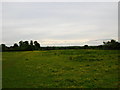
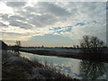
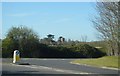
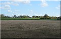
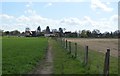
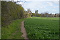
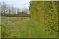
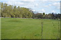
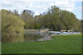
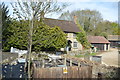

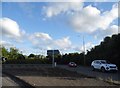
50 photos from this area
Area Information
Key information about the MK40 4HX including its size, population, and administrative classification.
- Area Type
- Postcode
- Area Size
- 2.1 hectares
- Population
- 1520
- Population Density
- 644 people/km²
House Prices in MK40 4HX
16
Properties
£777,329
Average Sold Price
£248,000
Lowest Price
£1,150,000
Highest Price
Showing 16 properties
| Address | Type | Beds | Baths | Last Sale Price | Last Sale Date | |
|---|---|---|---|---|---|---|
| 10 Hampden Court, Biddenham, MK40 4HX | Detached | 5 | 2 | £950,000 | Oct 2022 | |
| 7 Hampden Court, Biddenham, MK40 4HX | Retail | 4 | 2 | £855,000 | May 2022 | |
| 2 Hampden Court, Biddenham, MK40 4HX | house | - | - | £1,100,000 | Feb 2022 | |
| 12 Hampden Court, Biddenham, MK40 4HX | house | - | - | £1,140,000 | Nov 2020 | |
| March House, 11 Hampden Court, Biddenham, MK40 4HX | house | - | - | £1,060,000 | Nov 2019 | |
| 16 Hampden Court, Biddenham, MK40 4HX | house | - | - | £740,000 | Nov 2019 | |
| 1 Hampden Court, Biddenham, MK40 4HX | house | - | - | £740,000 | Sep 2018 | |
| 3 Hampden Court, Biddenham, MK40 4HX | house | 6 | - | £1,150,000 | Apr 2017 | |
| 14 Hampden Court, Biddenham, MK40 4HX | Detached | - | - | £565,000 | Jun 2005 | |
| 6 Hampden Court, Biddenham, MK40 4HX | Detached | - | - | £499,999 | Apr 2004 |
Page 1 of 2
Energy Efficiency in MK40 4HX
Amenities
Schools
| Rank | School | Type | Entry gender | Ages |
|---|
Explore more schools in this area
Go to Schools tabDemographics
Household Size
Family (3-5 people)
most common
Accommodation Type
Houses
most common
Tenure
86
majority
Ethnic Group
White
most common
Religion
N/A
most common
Household Composition
N/A
most common
Age
47
median
Adults (30-64 years)
most common
Household Deprivation
N/A
with no deprivation
NS-SEC
54
in Lower managerial occupations
Explore more demographic insights in this area
Go to Demographics tabPlanning
Planning Constraints
- Flood RiskPremium
- Ramsar Wetland SitesPremium
- Area of Outstanding Natural BeautyPremium
- Protected Nature ReservePremium
- Protected WoodlandPremium