Area Overview for MK40 3AH
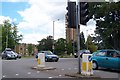
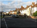
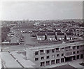
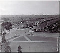
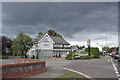
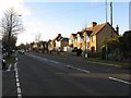
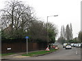
Photos of MK40 3AH


Area Information
Living in MK40 3AH offers a quiet, residential experience in a small cluster of homes with a population of 1,376. This area is defined by its compact size and proximity to Bedford’s rail network, making it accessible for commuters. The community is predominantly composed of adults aged 30–64, reflecting a mature, stable demographic. Daily life here balances local amenities with easy access to nearby towns. With no significant environmental constraints like protected woodlands or wetlands, the area is free from planning restrictions that might complicate development or living. The low flood risk and below-average crime rate of 83/100 further reinforce its appeal as a safe, low-stress environment. Residents benefit from strong digital connectivity, with broadband scores near 100, supporting remote work or online activities. While the area is small, its strategic location near Bedford’s rail stations and retail hubs ensures convenience without the density of urban living. For buyers seeking a peaceful, well-connected home with minimal risk, MK40 3AH presents a straightforward proposition.
- Area Type
- Postcode
- Area Size
- Not available
- Population
- 1376
- Population Density
- 7208 people/km²
MK40 3AH is characterised by a housing stock that is 54% owner-occupied, with houses making up the majority of properties. This suggests a focus on family homes rather than apartments or flats, which are less common in the area. The small population and compact nature of the postcode mean the housing market is limited in scale, with fewer properties available compared to larger towns or cities. For buyers, this could mean a competitive environment for the homes that do exist, particularly if they align with the preference for owner-occupation. The predominance of houses may appeal to those seeking space and privacy, though the lack of data on property sizes or price ranges means buyers must rely on local agents for specifics. Given the low crime rate and minimal environmental restrictions, the area may attract buyers prioritising safety and ease of planning for future developments. However, the small size of the area means buyers should consider nearby suburbs for broader options.
House Prices in MK40 3AH
No properties found in this postcode.
Energy Efficiency in MK40 3AH
Residents of MK40 3AH have access to a range of nearby amenities, including five retail outlets such as Budgens Bedford, M&S Newnham Av Bedford, and Co-op Bedford. These shops provide essential services and convenience for daily errands, reducing the need for long trips to larger centres. The area’s rail connectivity, with stations like Bedford St Johns and Kempston Hardwick, adds to its appeal by offering easy access to broader regional networks. While the data does not mention parks or leisure facilities directly, the absence of protected natural areas suggests open spaces may be limited, though nearby Bedford likely offers more options. The retail and transport infrastructure together create a lifestyle that balances local convenience with regional accessibility. For those who prefer a quieter existence, the area’s small size and low crime rate complement the practicality of nearby shops and rail links. The character of MK40 3AH is defined by its simplicity: a place where daily needs are met locally, and the wider world is reachable by train.
Amenities
Schools
| Rank | School | Type | Entry gender | Ages |
|---|
Explore more schools in this area
Go to Schools tabDemographics
The community in MK40 3AH is predominantly composed of adults aged 30–64, with a median age of 47. This suggests a population skewed toward middle-aged individuals, likely including families and professionals. Home ownership sits at 54%, with houses being the primary accommodation type. This indicates a mix of owner-occupied properties and rental units, though the exact proportion of rentals is not specified. The predominant ethnic group is White, though no further breakdown of diversity is provided. The absence of data on deprivation levels means no direct assessment of socioeconomic challenges, but the low crime rate and lack of environmental constraints suggest a relatively stable quality of life. The age profile implies a community with established routines, possibly with fewer young families compared to areas with higher birth rates. This demographic structure may influence local services and amenities, aligning them with the needs of older residents and professionals.
Household Size
Accommodation Type
Tenure
Ethnic Group
Religion
Household Composition
Age
Household Deprivation
NS-SEC
Explore more demographic insights in this area
Go to Demographics tabPlanning
Planning Constraints
- Flood RiskPremium
- Ramsar Wetland SitesPremium
- Area of Outstanding Natural BeautyPremium
- Protected Nature ReservePremium
- Protected WoodlandPremium