Area Overview for MK40 2LF
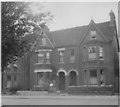
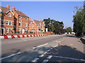
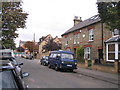
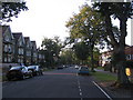
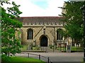
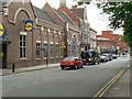
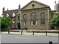
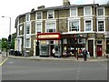
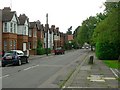
Photos of MK40 2LF

Area Information
MK40 2LF is a compact residential postcode area in England, covering just 2,278 square metres and home to 1,411 residents. Its high population density of 619,429 people per square kilometre reflects its small, tightly packed nature, typical of urban clusters. This area is defined by its proximity to essential services and transport links, making it practical for daily life. With a median age of 47 and a population skewed toward adults aged 30–64, the community is mature and stable. The area’s character is shaped by its mix of flats, which dominate the housing stock, and its accessibility to nearby amenities. While it lacks natural landscapes or protected areas, its strategic location near Bedford ensures convenience for shopping, commuting, and leisure. Living here means navigating a dense, functional environment where practicality outweighs space, appealing to those prioritising connectivity over expansive living areas.
- Area Type
- Postcode
- Area Size
- 2278 m²
- Population
- 1411
- Population Density
- 1921 people/km²
MK40 2LF is a rental-heavy area, with only 48% of residents owning their homes. The housing stock is almost entirely flats, a common feature in densely populated urban clusters. This suggests a lack of larger family homes or detached properties, which may limit options for buyers seeking such properties. The area’s small size and high density mean the property market is constrained, with limited scope for expansion or development. For buyers, this indicates a focus on secondary residences or investment in flats, rather than primary homes. The predominance of rental units also implies competition for available properties, particularly for those seeking owner-occupied housing. Prospective buyers should consider the area’s compact nature and the potential for limited choice in property types.
House Prices in MK40 2LF
No properties found in this postcode.
Energy Efficiency in MK40 2LF
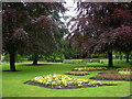
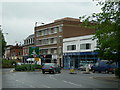
MK40 2LF’s residents have access to nearby retail hubs, including Budgens Bedford, Lidl Central, and Sainsburys Bedford, ensuring everyday shopping needs are met. These supermarkets are within practical reach, enhancing convenience for daily life. The area’s rail stations also connect to broader leisure and employment opportunities. While there is no mention of parks or recreational facilities in the data, the proximity to Bedford suggests potential access to larger green spaces or amenities in the surrounding town. The compact nature of the area means residents must rely on nearby towns for more extensive leisure options, but the presence of essential shops and transport links supports a functional, community-focused lifestyle.
Amenities
Schools
The nearest schools to MK40 2LF include Castle Newnham School, which operates as both a primary school and an academy. While no Ofsted ratings are provided, the presence of two school types suggests a range of educational options for families. The primary school caters to younger children, while the academy may offer a broader curriculum or specialist focus. This dual setup could benefit parents seeking either traditional schooling or alternative educational pathways. However, with only two schools listed, the area’s educational infrastructure appears limited, potentially requiring families to travel further for secondary education or specialist services. The proximity of these schools is a key consideration for homebuyers prioritising convenience for their children’s schooling.
| Rank | School | Type | Entry gender | Ages |
|---|
Explore more schools in this area
Go to Schools tabDemographics
MK40 2LF’s population of 1,411 is predominantly composed of adults aged 30–64, with a median age of 47. This suggests a community of established professionals and families, rather than students or retirees. Home ownership rates are 48%, meaning over half of residents rent, indicating a rental market dynamic. The area’s accommodation is largely flats, reflecting a preference for urban living or limited space. The predominant ethnic group is White, with no specific data on diversity beyond this. The high population density of 619,429 per square kilometre implies a tightly packed environment, which may influence living conditions and community interaction. For buyers, this demographic profile suggests a mature, stable area with a focus on practical housing rather than large family homes.
Household Size
Accommodation Type
Tenure
Ethnic Group
Religion
Household Composition
Age
Household Deprivation
NS-SEC
Explore more demographic insights in this area
Go to Demographics tabPlanning
Planning Constraints
- Flood RiskPremium
- Ramsar Wetland SitesPremium
- Area of Outstanding Natural BeautyPremium
- Protected Nature ReservePremium
- Protected WoodlandPremium