Area Overview for MK40 2AW
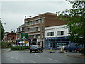
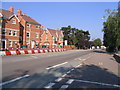
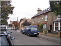
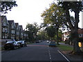
Photos of MK40 2AW


Area Information
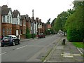
MK40 2AW is a small residential cluster in Bedfordshire, England, with a population of just 1,405. It is a compact area where daily life revolves around proximity to local amenities and transport links. The community is predominantly composed of adults aged 30–64, reflecting a mature demographic with established households. While the area is not large, it offers access to key services, including independent schools and retail outlets. The low flood risk and absence of protected natural sites suggest a relatively straightforward planning environment. However, the crime risk is medium, with a safety score of 57, indicating average local conditions. For those seeking a quiet, functional living space with practical connectivity, MK40 2AW provides a blend of residential comfort and accessibility to nearby urban hubs. Its small size means the character of the area is defined by its immediate surroundings, making it a viable option for buyers prioritising convenience over sprawling landscapes.
- Area Type
- Postcode
- Area Size
- Not available
- Population
- 1405
- Population Density
- 3613 people/km²
The property market in MK40 2AW is characterised by a low home ownership rate of 32%, indicating that the area is more rental-focused than owner-occupied. Flats are the primary accommodation type, which aligns with the small-scale, residential nature of the postcode. Given the limited population and housing stock, the market is unlikely to be highly competitive. Buyers considering the area should expect a limited selection of properties, with flats being the most common option. The immediate surroundings may offer similar housing types, but the small size of MK40 2AW means opportunities for expansion or development are constrained. For those seeking a rental property, the area’s proximity to transport links and amenities may make it an attractive choice, though the market remains niche.
House Prices in MK40 2AW
No properties found in this postcode.
Energy Efficiency in MK40 2AW
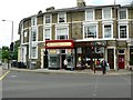
MK40 2AW offers access to a range of practical amenities within reach. The retail sector includes major chains such as Budgens Bedford, Lidl Central, and Tesco Bedford, providing convenience for everyday shopping needs. These stores cater to a variety of household requirements, from groceries to general supplies. The area’s rail network, with stations at Bedford, Bedford St Johns, and Kempston Hardwick, ensures easy access to urban centres and regional transport links. While the data does not mention parks or leisure facilities, the presence of retail and transport hubs suggests a functional lifestyle focused on accessibility rather than expansive recreational spaces. For residents prioritising convenience and connectivity, the area’s amenities align with a practical, community-oriented approach to daily living.
Amenities
Schools
Residents of MK40 2AW have access to three independent schools: Bedford School, St Andrew’s School, and The Acorn School. These institutions are privately funded, offering alternatives to state education. The presence of multiple independent schools suggests a demand for non-state schooling in the area, likely catering to families prioritising specific curricula or educational philosophies. However, no Ofsted ratings are provided for these schools, so prospective parents must conduct their own evaluations. The concentration of independent schools may indicate a community with a preference for private education, though the availability of state schools is not specified. For families seeking diverse educational options, the mix of independent institutions provides a range of choices, though the suitability of each school depends on individual needs and preferences.
| Rank | School | Type | Entry gender | Ages |
|---|
Explore more schools in this area
Go to Schools tabDemographics
The population of MK40 2AW is 1,405, with a median age of 47. The majority of residents fall within the 30–64 age range, indicating a community of middle-aged adults. Home ownership is relatively low at 32%, suggesting a significant proportion of residents rent their homes. Flats are the predominant accommodation type, which may reflect the area’s compact nature and limited space for larger properties. The dominant ethnic group is White, with no specific data on diversity beyond this. The age profile and home ownership figures suggest a stable, long-term resident base, though the rental market may influence the transient nature of some households. The absence of deprivation data means quality of life assessments are inferred from infrastructure and service availability rather than socioeconomic metrics.
Household Size
Accommodation Type
Tenure
Ethnic Group
Religion
Household Composition
Age
Household Deprivation
NS-SEC
Explore more demographic insights in this area
Go to Demographics tabPlanning
Planning Constraints
- Flood RiskPremium
- Ramsar Wetland SitesPremium
- Area of Outstanding Natural BeautyPremium
- Protected Nature ReservePremium
- Protected WoodlandPremium