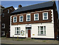
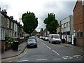
Area Overview for MK40 1DT
Photos of MK40 1DT


Area Information
Living in MK40 1DT offers a quiet, residential experience within a small cluster of homes. With a population of 2,541, this postcode area is compact, fostering a close-knit community feel. The area is defined by its modest scale, making it easy to navigate on foot or by bike. Residents here are predominantly adults aged 30–64, reflecting a mature demographic. The presence of multiple railway stations—Bedford Railway Station, Bedford St Johns, and Kempston Hardwick—ensures good connectivity to nearby towns. Daily life is shaped by proximity to retail hubs like Tesco Bedford and Iceland Greenhill, which cater to everyday needs. While the area lacks large-scale amenities, its simplicity and accessibility to surrounding services make it practical for those prioritising convenience over urban vibrancy. The low flood risk and absence of protected natural sites suggest a stable environment, though the moderate crime risk means standard precautions are advisable. MK40 1DT is not for those seeking a bustling metropolis, but it suits those valuing a calm, manageable lifestyle with straightforward access to transport and essentials.
- Area Type
- Postcode
- Area Size
- Not available
- Population
- 2541
- Population Density
- 14421 people/km²
The property market in MK40 1DT is largely rental-focused, with only 37% of homes owned by residents. This suggests a high proportion of private rentals, which may influence availability and pricing dynamics. The area is predominantly composed of houses, which contrasts with regions dominated by flats or apartments. For buyers, this means the housing stock is limited in scale but may offer traditional, family-friendly properties with gardens. The small size of the postcode area means the immediate surroundings are critical for property options, with nearby towns like Bedford providing additional choices. However, the low home ownership rate could indicate competition among buyers, particularly for properties with desirable features like proximity to transport links. Those considering purchase should factor in the area’s compact nature and the potential for limited stock, especially if seeking specific housing types.
House Prices in MK40 1DT
No properties found in this postcode.
Energy Efficiency in MK40 1DT
MK40 1DT’s lifestyle is shaped by its proximity to essential services. The nearby Tesco Bedford and Iceland Greenhill offer grocery and retail convenience, reducing the need for long trips. Multiple railway stations provide easy access to Bedford and surrounding areas, facilitating both daily commutes and weekend excursions. While the area lacks large parks or leisure facilities, its compact design means residents can reach nearby green spaces or recreational hubs in short distances. The presence of five retail points and multiple transport options suggests a practical, no-frills approach to daily living. This makes MK40 1DT ideal for those prioritising accessibility over expansive amenities, with a focus on simplicity and functionality in both shopping and travel.
Amenities
Schools
| Rank | School | Type | Entry gender | Ages |
|---|
Explore more schools in this area
Go to Schools tabDemographics
MK40 1DT’s population skews towards adults aged 30–64, with a median age of 47. This suggests a community of established professionals and families, rather than students or retirees. Home ownership here is relatively low at 37%, indicating that rental properties dominate the housing market. The area is characterised by houses rather than flats, which may appeal to those seeking more space or garden areas. The predominant ethnic group is Asian, reflecting a culturally diverse but tightly defined demographic. While no specific deprivation data is provided, the combination of mature age groups and lower home ownership could imply a mix of long-term residents and renters. The absence of detailed diversity metrics means broader social dynamics remain unexplored, but the presence of multiple retail and transport options suggests a functional, service-oriented community.
Household Size
Accommodation Type
Tenure
Ethnic Group
Religion
Household Composition
Age
Household Deprivation
NS-SEC
Explore more demographic insights in this area
Go to Demographics tabPlanning
Planning Constraints
- Flood RiskPremium
- Ramsar Wetland SitesPremium
- Area of Outstanding Natural BeautyPremium
- Protected Nature ReservePremium
- Protected WoodlandPremium