Area Overview for MK17 9ES
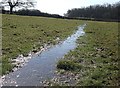
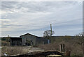
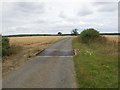
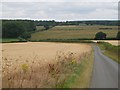
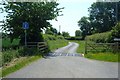
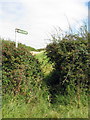
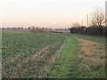
Photos of MK17 9ES

Area Information
Living in MK17 9ES means inhabiting a small, tightly knit residential cluster in England with a population of 1,417 people spread across 36 individuals per square kilometre. This area is characterised by its modest scale and quiet, mature community, where the majority of residents are adults aged 30–64. The low population density suggests a focus on private living rather than high-density housing, with homes predominating over other accommodation types. Daily life here is shaped by proximity to local amenities and schools, with nearby rail stations offering easy access to surrounding towns. While the area lacks large-scale commercial hubs, its compact nature ensures a sense of familiarity and ease of navigation. The demographic profile—centred on middle-aged residents with a strong presence of home ownership—suggests a stable, long-term community. For buyers, MK17 9ES offers a blend of practicality and tranquillity, with no major environmental or planning constraints to complicate property decisions. Its appeal lies in its simplicity: a place where needs are met locally, and the pace of life remains unhurried.
- Area Type
- Postcode
- Area Size
- Not available
- Population
- 1417
- Population Density
- 36 people/km²
The property market in MK17 9ES is defined by a 55% home ownership rate and a predominance of houses, indicating a community where private, long-term residency is the norm. This suggests a market skewed towards owner-occupied properties rather than rental demand, which may influence both property values and availability. With only 1,417 residents, the area is small enough that property choices are limited, though the focus on houses implies a potential for family homes or larger plots. Buyers should consider that the compact size of MK17 9ES means limited scope for expansion or development, and properties are likely to be in established, mature condition. The absence of high-density housing or commercial zones reinforces the area’s quiet, residential character. For those seeking a place with minimal planning constraints and a stable community, MK17 9ES offers a straightforward market, though its small size may restrict options for those prioritising variety or proximity to larger urban centres.
House Prices in MK17 9ES
No properties found in this postcode.
Energy Efficiency in MK17 9ES
The lifestyle in MK17 9ES is shaped by its proximity to essential amenities, including five retail outlets such as Spar, Co-op Heath &, and Co-op Underwood. These shops provide access to groceries and daily necessities, supporting a self-contained, low-maintenance lifestyle. The rail network, with stations like Aspley Guise and Woburn Sands, offers connectivity to nearby towns, enabling residents to access broader shopping, dining, and leisure opportunities beyond the immediate area. While the postcode itself does not list parks or recreational facilities, the nearby rail stations suggest access to larger green spaces in surrounding regions. The character of daily life here is defined by convenience and simplicity: local shops meet practical needs, and rail links ensure access to more dynamic environments. This balance between quiet residential living and functional connectivity makes MK17 9ES appealing to those seeking a relaxed, community-focused existence without sacrificing accessibility.
Amenities
Schools
Residents of MK17 9ES have access to a mix of primary and academy schools, including Eversholt Lower School, which operates both as a primary institution and an academy with an Ofsted rating of ‘good’. Ridgmont Lower School, also a primary school, has an Ofsted rating of ‘satisfactory’. These schools serve the local community, offering a range of educational pathways for younger families. The presence of both state-funded primary schools and an academy suggests diversity in teaching approaches and resources, though the exact curriculum or performance metrics are not detailed. For parents, the combination of school types may provide flexibility in choosing between traditional state education and the potentially more specialised resources of an academy. The proximity of these schools to residential areas ensures ease of access, though the small population of MK17 9ES means these institutions likely serve a broader regional catchment beyond the postcode itself.
| Rank | School | Type | Entry gender | Ages |
|---|
Explore more schools in this area
Go to Schools tabDemographics
MK17 9ES has a median age of 47, with the most common age range being adults aged 30–64. This indicates a mature, established population, likely with strong family ties and a focus on long-term residency. Home ownership rates stand at 55%, reflecting a balance between owner-occupied properties and rental stock, though the exact proportion of renters is not specified. The area is predominantly composed of houses, which aligns with the higher home ownership figures and suggests a preference for detached or semi-detached living. The predominant ethnic group is White, with no data provided on other demographics. The low population density of 36 people per square kilometre implies spacious, low-rise housing typical of rural or semi-rural settings. While deprivation data is absent, the combination of stable age groups, home ownership, and housing type points to a community with moderate economic stability, though further analysis would be needed to assess broader socioeconomic factors.
Household Size
Accommodation Type
Tenure
Ethnic Group
Religion
Household Composition
Age
Household Deprivation
NS-SEC
Explore more demographic insights in this area
Go to Demographics tabPlanning
Planning Constraints
- Flood RiskPremium
- Ramsar Wetland SitesPremium
- Area of Outstanding Natural BeautyPremium
- Protected Nature ReservePremium
- Protected WoodlandPremium