Area Overview for MK17 8HZ
Photos of MK17 8HZ
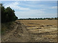
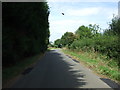
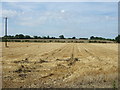
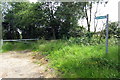
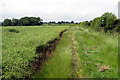
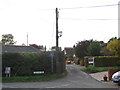

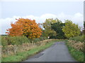
26 photos from this area
Area Information
Key information about the MK17 8HZ including its size, population, and administrative classification.
- Area Type
- Postcode
- Area Size
- 61.5 hectares
- Population
- 1193
- Population Density
- 126 people/km²
House Prices in MK17 8HZ
66
Properties
£354,980
Average Sold Price
£50,000
Lowest Price
£1,150,000
Highest Price
Showing 66 properties
| Address | Type | Beds | Baths | Last Sale Price | Last Sale Date | |
|---|---|---|---|---|---|---|
| 68 Salford Road, Aspley Guise, MK17 8HZ | Bungalow | 2 | 1 | £462,000 | Aug 2025 | |
| 94 Salford Road, Aspley Guise, MK17 8HZ | Semi-detached | 3 | 1 | £402,500 | Aug 2025 | |
| North Barn, 6 Salford Road, Aspley Guise, MK17 8HZ | Semi-detached | 4 | 1 | £670,000 | Jul 2025 | |
| 42 Salford Road, Aspley Guise, MK17 8HZ | Terraced | 2 | 1 | £367,500 | Jan 2025 | |
| 64 Salford Road, Aspley Guise, MK17 8HZ | Bungalow | - | - | £320,000 | Jun 2024 | |
| 70 Salford Road, Aspley Guise, MK17 8HZ | Retail | 2 | 1 | £400,000 | Nov 2022 | |
| 100 Salford Road, Aspley Guise, MK17 8HZ | Terraced | 2 | - | £315,000 | Nov 2020 | |
| 74 Salford Road, Aspley Guise, MK17 8HZ | Bungalow | - | - | £315,000 | Oct 2020 | |
| 24 Salford Road, Aspley Guise, MK17 8HZ | Detached | 4 | 2 | £550,000 | Apr 2019 | |
| 96 Salford Road, Aspley Guise, MK17 8HZ | Semi-detached | 3 | 3 | £450,000 | Nov 2018 |
Page 1 of 7
Energy Efficiency in MK17 8HZ
Amenities
Schools
| Rank | School | Type | Entry gender | Ages |
|---|
Explore more schools in this area
Go to Schools tabDemographics
Household Size
Two person
most common
Accommodation Type
Houses
most common
Tenure
60
majority
Ethnic Group
White
most common
Religion
N/A
most common
Household Composition
N/A
most common
Age
47
median
Adults (30-64 years)
most common
Household Deprivation
N/A
with no deprivation
NS-SEC
40
in Lower managerial occupations
Explore more demographic insights in this area
Go to Demographics tabPlanning
Planning Constraints
- Flood RiskPremium
- Ramsar Wetland SitesPremium
- Area of Outstanding Natural BeautyPremium
- Protected Nature ReservePremium
- Protected WoodlandPremium