Area Overview for MK17 8EJ
Photos of MK17 8EJ
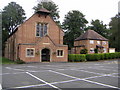
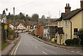
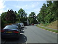
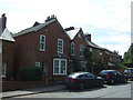
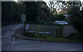
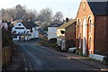
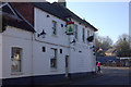
17 photos from this area
Area Information
Key information about the MK17 8EJ including its size, population, and administrative classification.
- Area Type
- Postcode
- Area Size
- 1.6 hectares
- Population
- 1264
- Population Density
- 423 people/km²
House Prices in MK17 8EJ
19
Properties
£772,727
Average Sold Price
£335,000
Lowest Price
£1,150,000
Highest Price
Showing 19 properties
| Address | Type | Beds | Baths | Last Sale Price | Last Sale Date | |
|---|---|---|---|---|---|---|
| 17 Wood Lane, Aspley Guise, MK17 8EJ | Detached | 4 | 2 | £795,000 | May 2025 | |
| 15 Wood Lane, Aspley Guise, MK17 8EJ | house | - | - | £935,000 | Nov 2022 | |
| Spring Bank, 19 Wood Lane, Aspley Guise, MK17 8EJ | house | - | - | £835,000 | Apr 2021 | |
| Hill House, Wood Lane, Aspley Guise, MK17 8EJ | house | - | - | £1,150,000 | Apr 2021 | |
| Pine Ridge, Wood Lane, Aspley Guise, MK17 8EJ | Detached | 5 | 3 | £1,125,000 | Jan 2021 | |
| Tylers, Wood Lane, Aspley Guise, MK17 8EJ | house | - | - | £1,030,000 | Nov 2018 | |
| 25 Wood Lane, Aspley Guise, MK17 8EJ | Detached | 4 | - | £690,000 | Sep 2015 | |
| Wood Haven, Wood Lane, Aspley Guise, MK17 8EJ | Detached | 6 | - | £400,000 | Nov 2013 | |
| 21 Wood Lane, Aspley Guise, MK17 8EJ | Semi-detached | - | - | £720,000 | Apr 2008 | |
| Kennel Cottage, Wood Lane, Aspley Guise, MK17 8EJ | Detached | - | - | £335,000 | Mar 2005 |
Page 1 of 2
Energy Efficiency in MK17 8EJ
Amenities
Schools
| Rank | School | Type | Entry gender | Ages |
|---|
Explore more schools in this area
Go to Schools tabDemographics
Household Size
Two person
most common
Accommodation Type
Houses
most common
Tenure
87
majority
Ethnic Group
White
most common
Religion
N/A
most common
Household Composition
N/A
most common
Age
47
median
Adults (30-64 years)
most common
Household Deprivation
N/A
with no deprivation
NS-SEC
55
in Lower managerial occupations
Explore more demographic insights in this area
Go to Demographics tabPlanning
Planning Constraints
- Flood RiskPremium
- Ramsar Wetland SitesPremium
- Area of Outstanding Natural BeautyPremium
- Protected Nature ReservePremium
- Protected WoodlandPremium