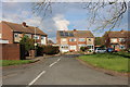
Area Overview for Maulden
Photos of Maulden


Area Information
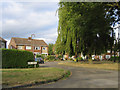
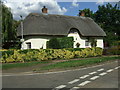
Maulden is a defined built-up area covering exactly 1.0 square kilometre within the wider English landscape. It functions as a settled residential community distinct from surrounding rural lands but integrated with nearby towns. The compact size means daily movements for most residents involve familiar local routes rather than long commutes within the settlement itself. Living in Maulden requires navigating a space where every house, garden, and street corner is potentially within easy reach of a neighbour. This geographical constraint creates a close-known environment where the boundaries of community are physically clear and measurable. You will find yourself surrounded by a historic settlement that retains its character despite modern connectivity gains. The area does not sprawl indefinitely; instead, it offers a contained living experience where noise and activity are naturally bounded by the 1.0 km² perimeter. For those considering homes in Maulden, the physical scale ensures that life is intimate rather than anonymous. Street life is immediate, and the distance to adjacent centres is fixed by the roads that cross this specific plot of land. The area operates as a stable local unit where residents interact with each other frequently due to the limited distance between properties. You live in a place where the map is small enough to recognise easily, yet connected enough to function independently. This balance defines the practical reality of daily life here.
- Area Type
- Built Up Area 250
- Area Size
- 1.0 km²
- Population
- Not available
- Population Density
- Not available
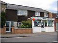
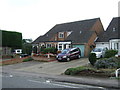
Daily convenience in Maulden is sustained by a curated selection of retail and rail connections that lie within practical reach. Five retail outlets operate nearby, with Budgens Maulden, Morrisons Daily, and Waitrose Ampthill standing out as specific notable names. You can manage weekly grocery shopping, wine purchases and household essentials by visiting these three named supermarkets without leaving the wider borough influence. The presence of a stores in this built-up area ensures that routine errands are handled without significant travel time beyond the immediate locality. Beyond retail, five rail stations serve the broader region, with Flitwick Railway Station, Millbrook Railway Station, and Stewartby Railway Station listed as the key notable access points. While the station count includes the wider area, these named termini offer direct links to national network hubs. This rail configuration means that commuting to London or other major cities is facilitated by established rail lines rather than relying solely on buses. The mix of local shops and regional rail options creates a lifestyle where everyday needs are met locally while longer journeys remain efficient. You will find that the combination of five shops and five confirmed stations provides a robust framework for independent living. The named venues like Waitrose Ampthill suggest a standard of quality available for those seeking fresh produce and prepared meals.
Amenities
Schools
Families relying on education will find one primary option immediately accessible within the local area. Maulden Lower School is the specific establishment listed for this neighbourhood and operates at the primary level. The school carries a Good rating from Ofsted, providing verified assurance of educational standards for parents. This single rating covers the entire facility, ensuring that the main educational provision is of a high quality according to government inspectors. There is no secondary school data provided for Maulden in the current records, so families must look towards neighbouring towns for older children. The presence of one listed primary school suggests that the area serves as a catchment zone for younger pupils rather than offering a full academy group locally. When planning schools near Maulden, you should factor in that the immediate vicinity supports a primary education phase with a proven track record. The Good rating from Ofsted indicates that the institution meets established criteria for teaching, learning and student welfare. Parents wishing to secure a place for their children can rely on this specific institution as the primary local resource. The data does not include alternative primary providers or specialist academies, so Maulden Lower School remains the definitive choice for local education. This clarity simplifies the search process for those prioritising proximity to a verified educational establishment.
| Rank | A + A* % | School | Type | Entry gender | Ages |
|---|---|---|---|---|---|
| 1 | N/A | Maulden Lower School | primary | N/A | N/A |
Explore more schools in this area
Go to Schools tabDemographics
The community in Maulden presents a clear demographic picture dominated by an older population. The median age stands at 70 years, indicating that half the residents are older than this figure while the other half are younger. This age profile suggests a neighbourhood where retirement and established families make up the core of the population. The most common age group covers the total demographic spectrum, reflecting a fairly steady distribution across different life stages despite the high median. Home ownership is exceptionally high at 78%, meaning the vast majority of inhabitants own their dwellings outright or with a mortgage. This level of equity suggests low turnover and long-term residents who have put down roots deeply in the area. Household composition data is recorded under the total category, showing the aggregate makeup of living units without separate subgroup breakdowns. Accommodation types are similarly aggregated under a total classification, meaning you cannot isolate specific property constructions like semdetorials or flats individually from this source. Religious and ethnic diversity data are recorded in total categories, indicating that these broad listings encompass the entire population of the built-up area. There is no separate deprivation index provided in the records, so the quality of life discussion relies on other factors like age and ownership rates. The 78% ownership rate implies a community where people often stay for decades, leading to strong local networks. The average age further reinforces the idea that this is a place for settled living rather than for young professionals or transient workforce groups.
Household Size
Accommodation Type
Tenure
Ethnic Group
Religion
Household Composition
Age
Household Deprivation
NS-SEC
Explore more demographic insights in this area
Go to Demographics tabPlanning
Planning Constraints
- Crime RiskLocked