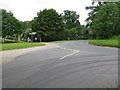
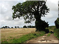
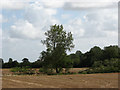
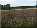
Area Overview for Matlask
Photos of Matlask
Area Information
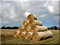
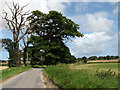
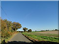
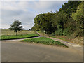
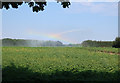
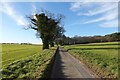
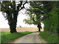
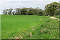
Living in Matlask offers a distinctly rural experience within a defined civil parish. This area covers a total of 8.7 km², providing ample green space for residents who prefer a quiet life away from the urban sprawl. The community is characterised by a strong sense of locality, where daily life involves close proximity to natural surroundings rather than city noise. You will find that the landscape supports a slower pace, ideal for those seeking escape from the hustle of larger towns. There are no major planning constraints such as Ramsar sites or areas of outstanding natural beauty that complicate development, but the presence of protected woodland suggests a commitment to preserving the local environment. The neighbourhood caters primarily to individuals who value stability over rapid urban growth. With a low flood risk score of 1.9, this parish remains resilient against water-related hazards. Most residents do not face these specific environmental challenges, allowing them to focus on enjoying the open spaces. The small footprint means you will know your neighbours quickly, yet the isolation ensures privacy. It is a place where the geography defines the lifestyle, offering a established setting that attracts those happy with a limited range of large-scale amenities nearby.
- Area Type
- Parish
- Area Size
- 8.7 km²
- Population
- Not available
- Population Density
- Not available
Demographics
The community in Matlask is defined by an older population profile, which shapes the overall character of daily life here. The median age stands at 70, significantly higher than the national average, indicating that this parish is a destination for retirement and earlier life stages. You will primarily encounter residents who have chosen to settle down rather than young families seeking schools or singles looking for entry-level housing. This age demographic influences the types of activities and services that matter most to locals. Home ownership is a dominant feature of life in Matlask, with 73% of homes occupied by their owners. This high statistic reflects a population that has invested in long-term living arrangements and often builds equity over decades. The remaining 27% of households rely on renting, which is a smaller proportion compared to many other regions. While data on specific household composition types beyond the total is not available, the ownership rate suggests stability. The area lacks the transient feel often found in rental-heavy districts. Instead, you will find a settled community where people have往往会 stayed for extended periods. The diversity and religious makeup are recorded as totals in official records, but the cultural fabric clearly centres around the needs of mature adults.
Household Size
Accommodation Type
Tenure
Ethnic Group
Religion
Household Composition
Age
Household Deprivation
NS-SEC
Explore more demographic insights in this area
Go to Demographics tabPlanning
Planning Constraints
- Flood RiskPremium
- Ramsar Wetland SitesPremium
- Area of Outstanding Natural BeautyPremium
- Protected Nature ReservePremium
- Protected WoodlandPremium
- Crime RiskPremium