Area Overview for Martlesham & Purdis Farm Ward
Photos of Martlesham & Purdis Farm Ward
Area Information
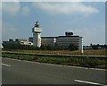
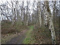
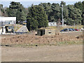
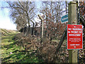
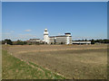
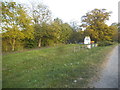
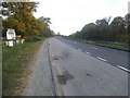
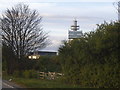
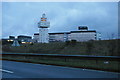
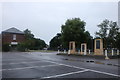
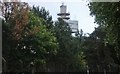
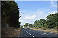
Living in Martlesham & Purdis Farm Ward offers a distinct experience on the eastern fringe of Ipswich. This district covers 23.2 km² within East Suffolk and sits approximately 4¼ miles south-east of the town centre. The landscape blends suburban housing with significant industrial development and open farmland. You will find the Warren Heath area here, alongside substantial portions of the local civil parish. Major features include the Suffolk Agricultural Association Showground at Trinity Park and the well-established Ipswich Golf Club. The area is not merely residential but incorporates designated green spaces like Purdis Heath. This location is listed as a Site of Special Scientific Interest thanks to its historic decoy ponds dating back to the 17th century. Part of the nearby Bixley Heath also falls within the parish boundaries, holding similar scientific importance. The Suffolk Sandlings Walk passes directly through the ward, providing accessible country trails. Suggestive historical layers remain visible today; Warren Heath contains the physical remains of an ancient settlement from the 8th to the 12th century. While the name derives from a long-gone St Petronella church, 17th-century records reference a tenement called Purdeys. The land changed hands frequently over centuries, eventually seeing housing development in the 1950s after the Broke Hall Estate sold parcels to developers and the golf club. You are entering a community defined by this mix of agricultural economy, leisure facilities, and deep historical roots.
- Area Type
- District Borough Unitary Ward
- Area Size
- 23.2 km²
- Population
- Not available
- Population Density
- Not available
Demographics
The community profile for Martlesham & Purdis Farm Ward presents a notably older population compared to many parts of Britain. The median age stands at exactly 70 years. Historical records from the Saumarez Family Archive indicate the area dates back to 1646, giving long-term residents a deep connection to the land. Consequently, the most common age range covers the total population heavily weighted towards seniors. Approximately 80% of households own their homes outright or with a mortgage, indicating a traditional settled community rather than a transient rental market. The demographic data does not specify predominant ethnic groups, religious affiliations, or detailed household composition figures beyond the overall age metrics. High home ownership rates suggest residents value stability. The lack of young families or professionals in the dataset implies a quieter, perhaps more leisure-focused daily rhythm. You might find fewer children playing on local streets than in other wards. The area functions as a retirement-oriented zone or a hub for older adults. While specific diversity statistics are absent from the provided records, the heavy concentration of seniors over 70 shapes the local social services and community needs. This demographic reality means local amenities cater significantly to older lifestyles.
Household Size
Accommodation Type
Tenure
Ethnic Group
Religion
Household Composition
Age
Household Deprivation
NS-SEC
Explore more demographic insights in this area
Go to Demographics tabPlanning
Planning Constraints
- Flood RiskPremium
- Ramsar Wetland SitesPremium
- Area of Outstanding Natural BeautyPremium
- Protected Nature ReservePremium
- Protected WoodlandPremium